Hiking Mount Katahdin is simply an incredible experience. As you approach Baxter State Park, you see off in the distance the rocky and steep slopes of the highest peaks in all of Maine. Most who come have read about, seen pictures or watched videos of hikers along the Knife’s Edge (I know I did). Anticipation of standing atop is nearly unbearable. No matter how many videos you watch, you will still be an awe standing atop. Whether you have hiked Katahdin 15 times, or are approaching the trailhead for the first time, excitement builds, and the views don’t disappoint (weather permitting of course).
Quick Navigation:
Trails | Trail Map | Directions | Current Weather | Pictures
Elevation: 5,269 feet (1,606 meters)
Elevation Gain: Around 3,900 feet (1189 meters) depending on the trail.
Difficulty: Strenuous
Distance: 8.6 miles (14.84 km)
Duration: 5-10 hours
The video below features a section of the knife edge showcasing the steep drop-offs and views.
Need To Know Information
- Hiking Katahdin requires hikers to either stay at a Baxter State Park Campground, or purchase a parking permit ahead of time. There are first come first serve parking spots, but it is not recommended to rely on this in busy seasons. Out of state residents can’t reserve a spot more than two weeks out from the trip. You can read the information here: https://baxterstatepark.org/general-info/#reserve
- No dogs are allowed in Baxter State Park
- A special reservation is required for traveling above treeline in winter. You can read about this here: https://baxterstatepark.org/winter-basics/
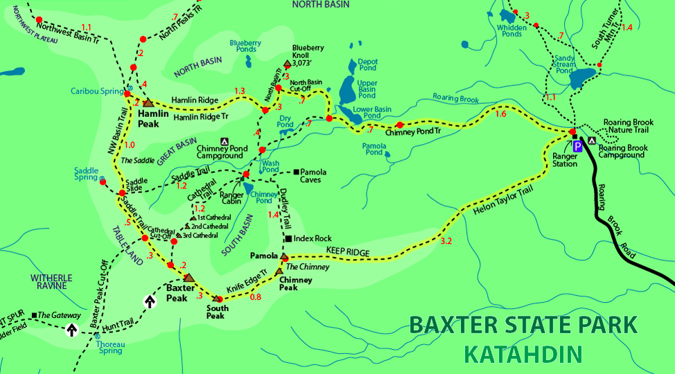
Trails
Knife Edge – 1.1 miles connecting Katahdin and Pamola
This trail is ridiculously awesome. It features insane views in all directions, steep ledges, lots of rock scrambling, cliffs and sometimes even a little danger. Anyone without a fear of heights, and comfortable rock hopping and also comfortable with a short rock climb should do this trail. It is worth it. Keep in mind it is especially dangerous when wet, windy or cold.
Elevation Gain of 365 feet from Pamola to Katahdin
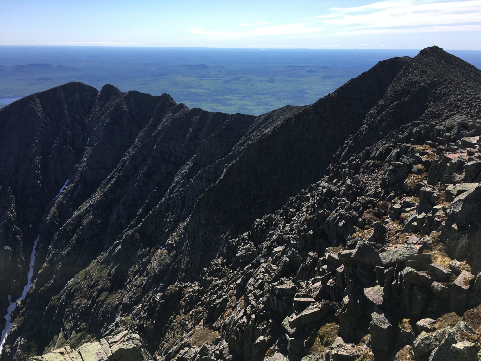
View of Knife Edge from Katahdin Peak
Abol Trail – 4.3 miles base to summit (3,900 foot gain)
The Abol Trail was a great trail up to the peak of Katahdin. It begins at Abol Campground within Baxter state park. It meets up with the Hunt trail near the summit. It is the shortest trail up to the summit and offers some rock scrambling, lots of exposed hiking and quickly gets you above treeline. The trail has no large stream crossings. Though it has quite a few steep sections, it certainly has less scrambling than the Hunt Trail.
Elevation Gain: 3,982 Feet
Hunt Trail – 5.2 miles base to summit (4,188 foot gait)
The Hunt trail is the last trail (or first) for AT thru-hikers. It begins at Katahdin Stream Campground and quickly reaches the summit of Katahdin. It features a beautiful waterfall 1.1 miles from the campground, quick access to the trail above treeline and tons of rock scrambling. The views are incredible the majority of the way up, and the rock scrambling is very fun.
Helon Taylor Trail – 4.3 miles base to summit
This is also another fantastic option up Mount Katahdin. This trail takes you from the ranger station to Pamola Peak, before joining with the Knife Edge. Hikers often take this route to do a large loop over to Hamlin Peak as well.
Dudley Trail – This trail is currently shut down due to unstable rock.
Hunt Trail Views on Mount Katahdin
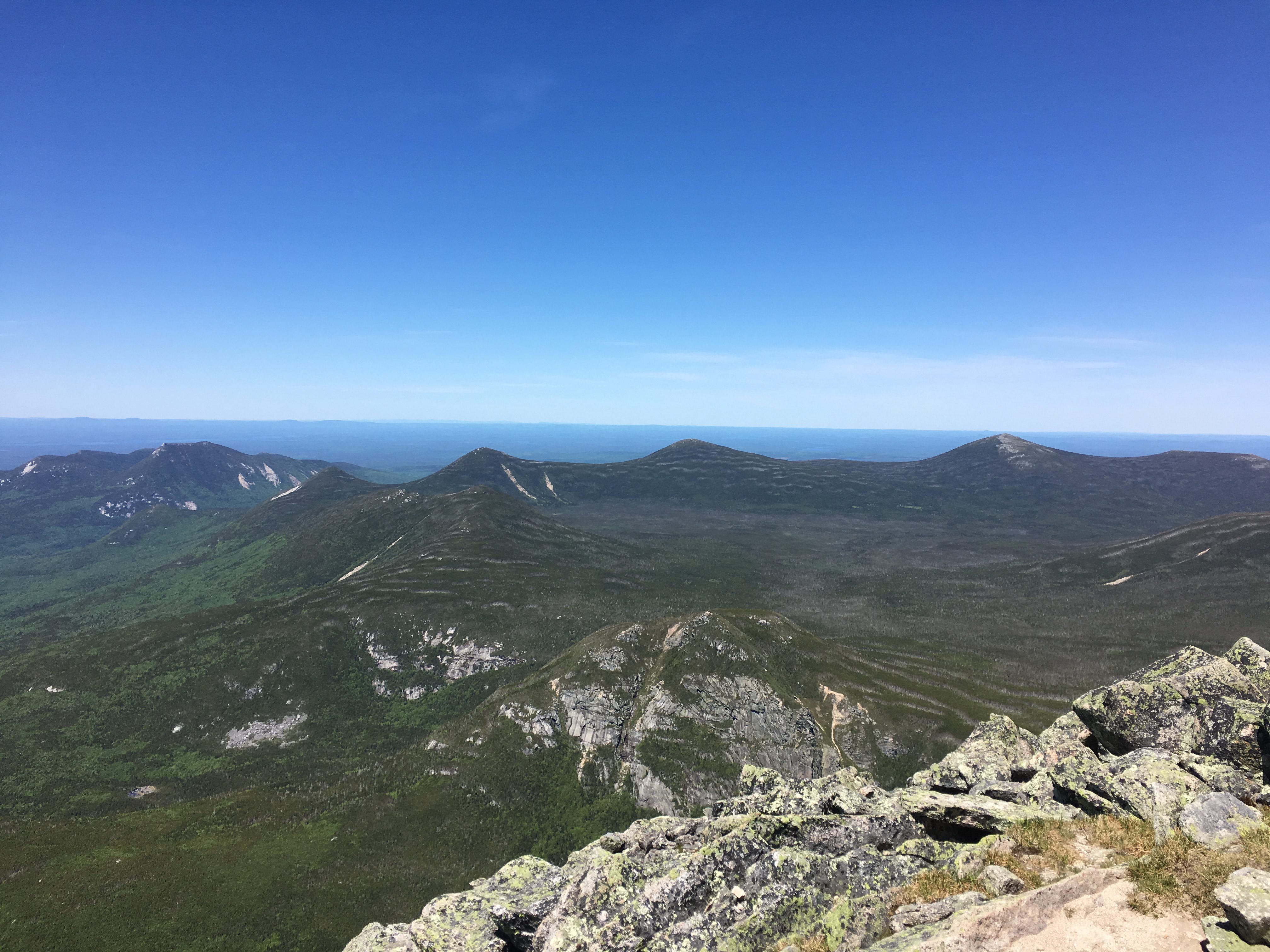
Hamlin Peak
Hamlin Peak is the second highest mountain in Maine at 4,757 feet, and is often hiked in an 11.2 mile loop starting and ending at the Ranger Station of Baxter State Park.
Trail Map
What Does Katahdin Mean?
Katahdin was given its name by the Penobscot Indians, that lived in the area. It means “the greatest mountain”. When you first lay eyes on the mountain, you can understand why, as the peaks of Baxter State park rise rapidly from the surroundings.
Baxter State Park Camping
If you plan to stay in or around Baxter State park for more than a day, you have many options. Not only can you stay within the park at numerous campgrounds, but surrounding towns have places you can stay. Many offer shuttles into the park. You can find all of the information you need about camping within the park here: https://baxterstatepark.org/camp-summer/
Northern Terminus of the Appalachian Trail
Mount Katahdin is the most northern point of the Appalachian Trail, making it the final destination for many AT thru-hikers. During the summer months, you will frequently see finishes posing on the summit sigh marking the end of the incredible 2,190+ mile journey they just embarked on.
Directions
Here is the address of Baxter State Park.
Weather Forecast
Millinocket, ME
Overnight
Isolated snow showers. Mostly cloudy, with a low around 11. Wind chill values as low as -7. West wind around 21 mph. Chance of precipitation is 20%. Little or no snow accumulation expected.
Sunday
Isolated snow showers. Partly sunny, with a high near 16. Wind chill values as low as -4. West wind 9 to 18 mph. Chance of precipitation is 20%. Little or no snow accumulation expected.
Sunday Night
Isolated snow showers before midnight. Partly cloudy, with a low around 11. Wind chill values as low as -2. West wind around 13 mph. Chance of precipitation is 20%.
Monday
A slight chance of snow showers between 7am and 11am. Mostly cloudy, with a high near 12. Wind chill values as low as -1. West wind 7 to 10 mph. Chance of precipitation is 20%.
Monday Night
Mostly cloudy, with a low around 5. Northwest wind 8 to 12 mph.
Tuesday
Scattered snow showers between 9am and 5pm. Mostly cloudy, with a high near 10. Northwest wind around 12 mph.
Tuesday Night
Mostly cloudy, with a low around 4. West wind 9 to 14 mph.
Want More Info on Hiking Katahdin?
Take a look at this valuable resource on each trail up Katahdin: https://baxterstatepark.org/general-info/
More Pictures
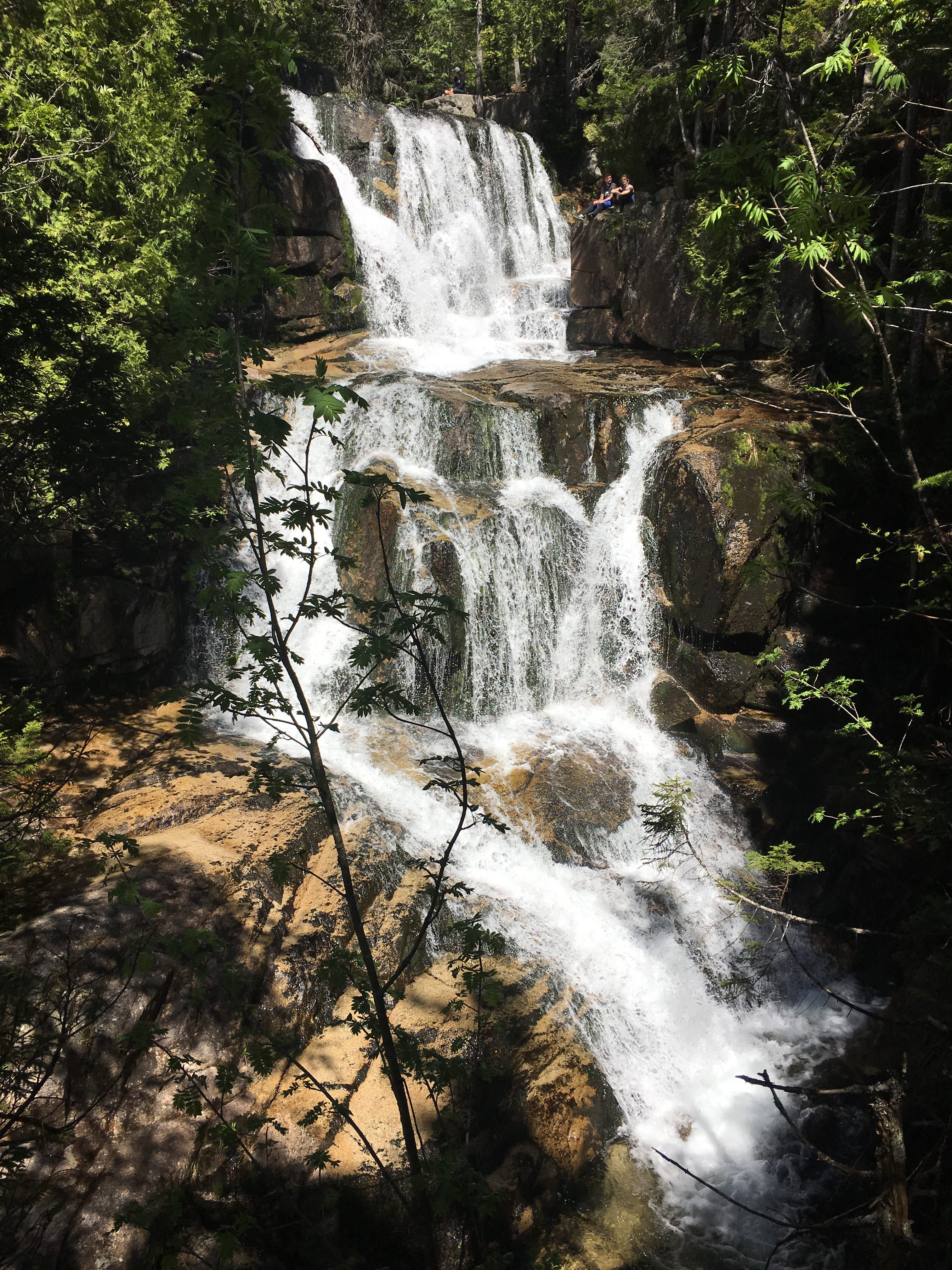
Waterfall on Hunt Trail
View of Katahding Peak from Knife Edge
View of Basin From Knife Edge
Looking Across Knife Edge
Views from Hunt Trail
View of Lakes from Hunt Trail
View of Katahdin Peak from Hunt
Pano from Hunt Trail
Lake Views from Hunt Trail
If you have any questions regarding this hike or anything else. Don’t hesitate to reach our via the Contact page. Please share this post!
Max DesMarais is the founder of hikingandfishing.com. He has a passion for the outdoors and making outdoor education and adventure more accessible. Max is a published author for various outdoor adventure, travel, and marketing websites. He is an experienced hiker, backpacker, fly fisherman, backcountry skier, trail runner, and spends his free time in the outdoors. These adventures allow him to test gear, learn new skills, and experience new places so that he can educate others. Max grew up hiking all around New Hampshire and New England. He became obsessed with the New Hampshire mountains, and the NH 48, where he guided hikes and trail runs in the White Mountains. Since moving out west, Max has continued climbed all of the Colorado 14ers, is always testing gear, learning skills, gaining experience, and building his endurance for outdoor sports. You can read more about his experience here: hikingandfishing/about