Mount of The Holy Cross is a 14,005 foot mountain in the White River National Forest of Colorado. Don’t let the fact that this mountains is one of the smaller CO 14ers fool you, the elevation gain is significant here, making for a strenuous, but very rewarding hike.
Difficulty – Strenuous
Distance – 11.2 miles round trip (18.02 km)
Height – 14,005 feet (4,268.7 meters)
Elevation gain –4,910 Feet (1,496.6 meters)
Duration – 7-9 hours (book time)
Hike Class: Class 2
Trailhead Elevation – 10,320 ft (3,145.5 meters)
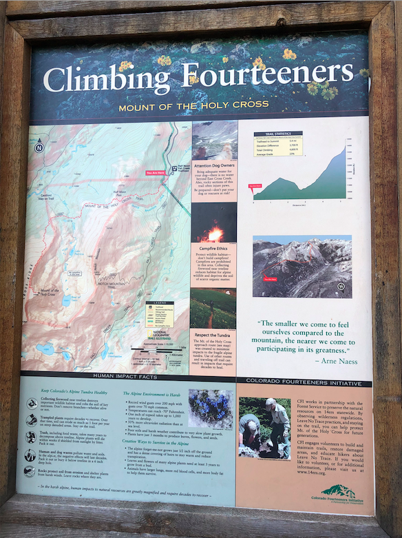
Trail Map
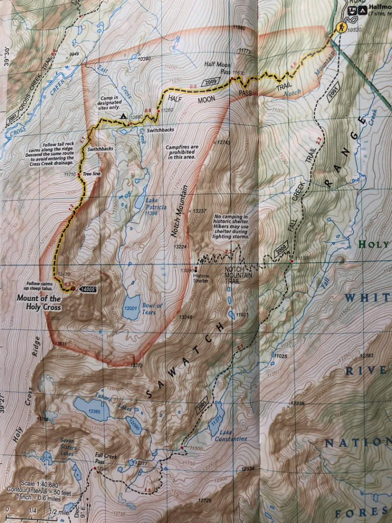
Trails
Half Moon Pass Trail | 11.2 Miles Round Trip | 4,910 Feet Elevation Gain
There is really only one established and normal hiking route up to the summit of Mount of The Holy Cross. This trial begins at Halfmoon Campground (10,320 feet) at the end of Tigiwon Road in Minturn, CO (directions below).
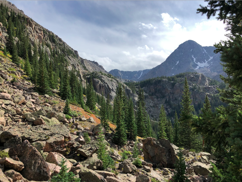
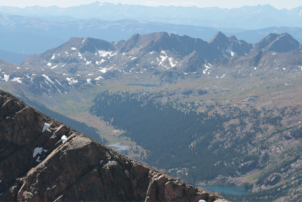
The trail begins below treeline and steadily inclines to Halfmoon Pass (1.6 miles in) at 11,630 feet. Hikers will have just ascended above treeline, and will have to descend another 1.4 miles down to 10,680 feet. This descent features some fantastic views of the summit of Mount Holy Cross, the lakes below, and the campsites below.
Around 2.2 miles into this hike, hikers will reach the the back country tentsites. These are some really great camping spots and are first come first serve (more info below). Hikers will be at 10,680 feet here. This is a great way to turn this hike into an overnight hike.
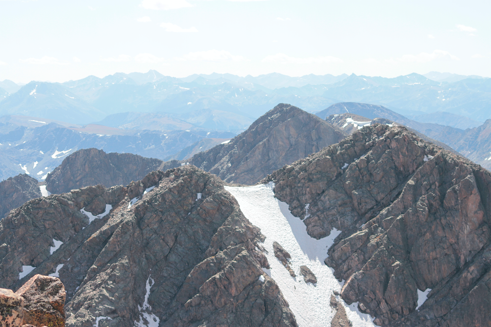
The ascent begins here, where hikers will steadily climb above treeline in about 1.1 miles, and will follow cairns along the rocky ridge to the summit. The views are outstanding the entire way above treeline. Hikers will continue a steep ascent for .4 miles before the trail gets more gradual along the ridge. 1.2 miles after treeline, hikers will reach the last push to the summit. Here the trail gets significantly more steep, and is made up of large boulders that can be difficult to navigate. This is .3 miles to the summit. Hikers should follow the cairns to the top.
Alternate Routes
Not really alternate routes for hikers. Climbers may seek a class 3 route up Cross Couloir. This will take you up a steep snowy section. This is also a common back country ski/snowboard area.
Hiking in Winter
Tigiwon road is closed to vehicles in late fall until mid June. (Normally June 21 pending snow) Check near these times to be sure the road is open. Hikers will still hike in winter, but it turns this into a 31 mile hike with over 7,000 feet of elevation gain. The road to the trailhead is frequented by snowmobiles, so that is an option as well. Extreme caution and preparation should be taken.
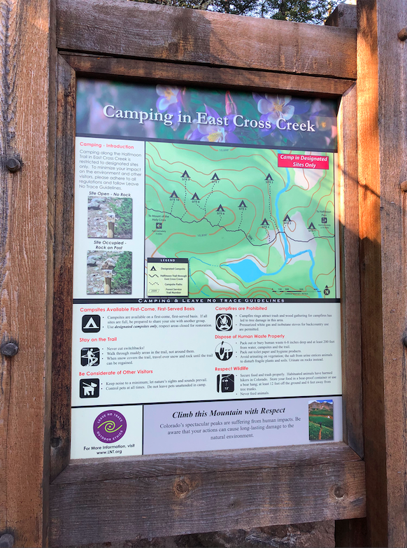
Camping Information
There are two camping areas for hikers. Halfmoon Campground at the trailhead, and tent sites located around 2.3 miles into the hike.
Halfmoon Campground
Halfmoon is located at the trailhead and end of Tigiwon road. The open season is from the third week in June to the first week in October. Fee is $15 per night for a single unit. This is done via fee envelopes in a collection box. First come first serve, no reservations. There are 7 tent sites. The trailhead has a bathroom. Each tent site has a picnic table and a campfire grate.
Tent Sites
These tent sites begin around 2.2 miles into the hike. There are 10 tent sites, first come, first serve. Campsites are marked as filled if a hiker puts a rock on the tentsite marking. Campfires are prohibited at these sites. Be prepared to share your tentsite if spaces are full. These sites are large enough to share. Camping fee is paid at trailhead via envelope: $15. A map of the tent sites can be found in the pictures section below.
Current Weather Conditions
Here is a detailed forecast for the next 4 days:
Red Cliff, CO
This Afternoon
Sunny, with a high near 22. West northwest wind around 5 mph.
Tonight
Clear, with a low around 6. West northwest wind 5 to 10 mph.
Monday
Sunny, with a high near 26. West northwest wind 5 to 10 mph.
Monday Night
Mostly clear, with a low around 6. Wind chill values as low as -10. West southwest wind 5 to 15 mph.
Tuesday
Mostly sunny, with a high near 26. West southwest wind 5 to 15 mph.
Tuesday Night
Mostly clear, with a low around 7.
Wednesday
Sunny, with a high near 25.
Directions & Parking
Fill out a Wilderness Registration Card. Camping and overnight fees are $15 per day. The road is rough and dirt. High clearance 2wd can make it during summer, but an AWD vehicle is recommended.
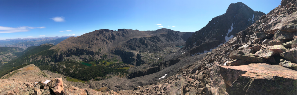
Additional Pictures
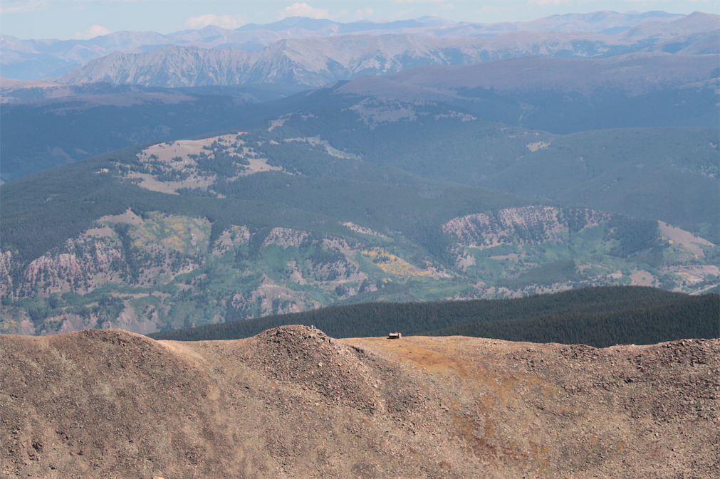
Mount of The Holy Cross Views of Lodge
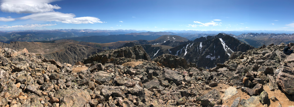
Mount of The Holy Cross Pano Views
Mount of The Holy Cross Trailhead Sign 1
Mount of The Holy Cross Trailhead Sign 2
Mount of The Holy Cross Trailhead Sign 3
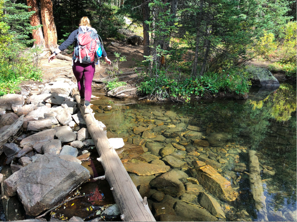
Small Stream Crossing Near Campsites
Views Heading Down Towards Campsites
Mount of The Holy Cross Summit Views
Mount of The Holy Cross Views
Max DesMarais is the founder of hikingandfishing.com. He has a passion for the outdoors and making outdoor education and adventure more accessible. Max is a published author for various outdoor adventure, travel, and marketing websites. He is an experienced hiker, backpacker, fly fisherman, backcountry skier, trail runner, and spends his free time in the outdoors. These adventures allow him to test gear, learn new skills, and experience new places so that he can educate others. Max grew up hiking all around New Hampshire and New England. He became obsessed with the New Hampshire mountains, and the NH 48, where he guided hikes and trail runs in the White Mountains. Since moving out west, Max has continued climbed all of the Colorado 14ers, is always testing gear, learning skills, gaining experience, and building his endurance for outdoor sports. You can read more about his experience here: hikingandfishing/about