The mist trail is one of the “must do” trails in Yosemite National Park. It takes hikers to Vernal Falls, Nevada Falls, and is the starting point for hikers heading up Half Dome as well. The trail features incredible views, and allows hikers to do a long day of hiking, or turn around where they would like along the way up the canyon. In this article, we’ll cover everything you should know.
Quick Navigation:
Trail Map | Trails | Hiking In Winter | Camping | Directions | Pictures
Difficulty – Intermediate
Distance – 2.4 miles (3.9 km) round trip to Vernal Falls, 5.8 miles (8.7 km) round trip to Nevada Falls, add 1.5 miles round trip if hiking from Curry Village
Height – 5,909 feet (1801.06 m)
Elevation gain –1,000 feet (300 meters) to the top of Vernal Fall; 2,000 feet (610 meters) to the top of Nevada Fall
Duration – 4-6 hours round trip to Nevada Fall (book time)
Hike Class: Class 2
Trailhead Location – Mist Trailhead (4,059 feet (1237 meters)
Dogs – Not allowed
Need To Know Information
- A permit is required to enter Yosemite at many parts of the year: https://www.nps.gov/yose/planyourvisit/permitsandreservations.htmhttps://www.fs.usda.gov/recarea/arp/recarea/?recid=8080
- Additional permits are not required to hike this trail unless hikers are spending the night at tent sites above, or are hiking to half dome.
- You can hike to both waterfalls year round, but there are trail closures to take into account. Read the status of the trails and the routes needed to take here: https://www.nps.gov/yose/planyourvisit/vernalnevadatrail.htm
Trail Map
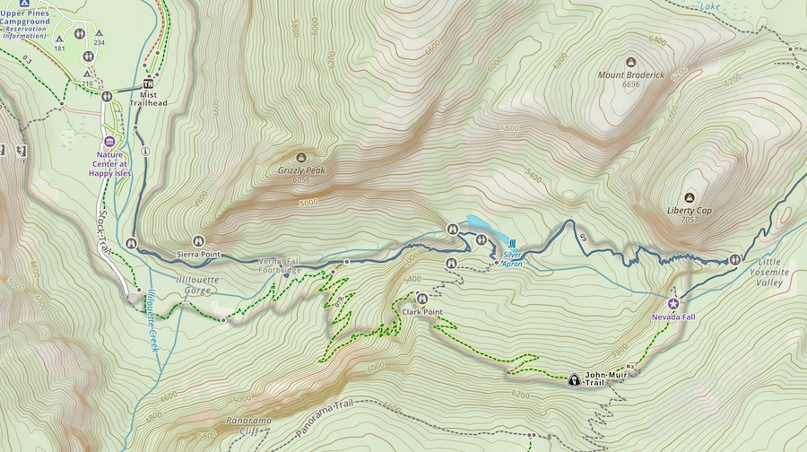
Routes
The Mist Trail is the recommended and most common starting point for these waterfalls. Hikers will see on the trail map that the John Muir Trail also connects with these falls. Our recommendation is to make a bit of a loop if possible as this gives hikers a unique view of the falls that is worth the increased mileage and distance.
Mist Trail – 5.8 Mile Round Trip
Because these trails are so well traveled, they are well marked, and easy to follow. There are views at many different points of the hike of the waterfalls as you approach them. The Mist Trail also gets its name because you will end up getting in the mist of these waterfalls. That means hikers will get wet, and hikers will encounter wet and slippery trails.
The hike quickly starts gaining vertical on paved trail for the first mile. It is scenic at just about every moment. About a mile in, hikers will be hitting the portion of trail that diverges to the John Muir Trail, and the mist trail continues up over 600 misty steps with incredible views.
Hikers continue to above the falls where they can continue on to Emerald Pool, Silver Apron, and Vernal falls, or they can loop back down the John Muir Trail.
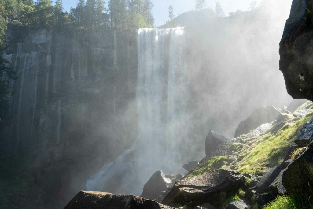
The trail continues upward towards Vernal Valls. The views are stunning at every moment. Hikers can then hike above Vernal falls and have the option once again to return the way they came, continue on (not usual), or to loop back down the John Muir Trail for unique views that are completely worth it.
Mist Trail & John Muir Trail Loop Around Nevada Falls – 8 Mile Loop
This is our most recommended loop, and will be an 8 mile and just over 2,000 feet of elevation gain loop.
Hiking in Winter
Refer to trail closures and winter hiking info here.
Camping Information
Nearby lodging and campground information can be found here.
And getting backcountry/wilderness camping permit info can be found here.
Weather
Here is a detailed weather forecast for the area:
Yosemite Valley, CA
This Afternoon
Partly sunny. High near 50, with temperatures falling to around 45 in the afternoon. East northeast wind around 0 mph.
Tonight
Mostly clear, with a low around 39. East wind 0 to 5 mph.
Monday
Sunny. High near 50, with temperatures falling to around 44 in the afternoon. North northeast wind around 0 mph.
Monday Night
Mostly clear, with a low around 38. East northeast wind around 5 mph.
Tuesday
Sunny, with a high near 50. North wind 0 to 5 mph.
Tuesday Night
Mostly clear, with a low around 36. North northeast wind 0 to 5 mph.
Wednesday
Sunny, with a high near 51. North wind 0 to 5 mph.
Directions
Directions to Mist Trail Trailhead:
Additional Pictures
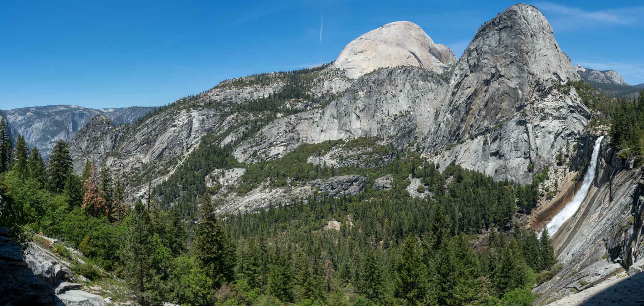
Nevada Falls from John Muir Trail
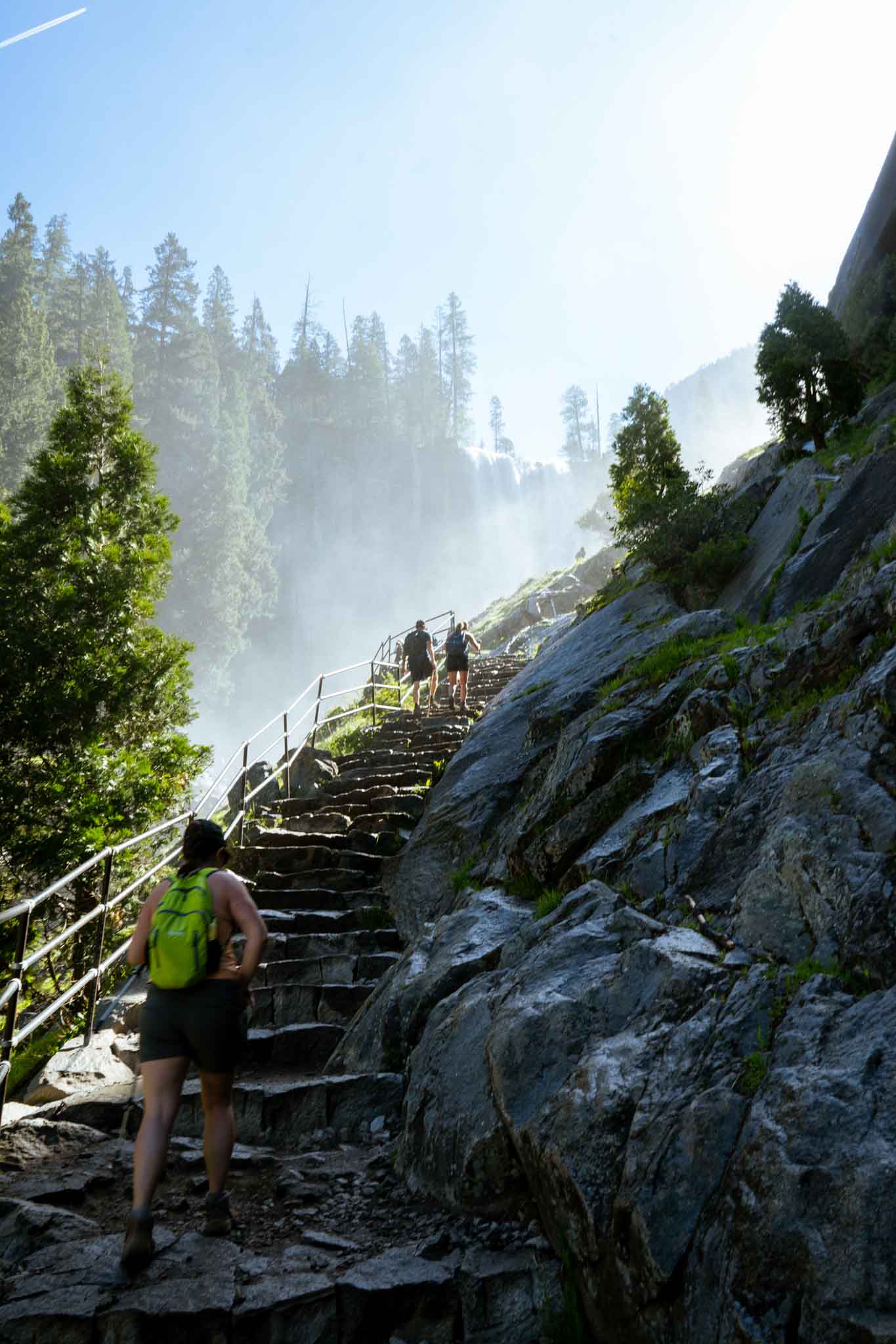
A very misty Mist Trail
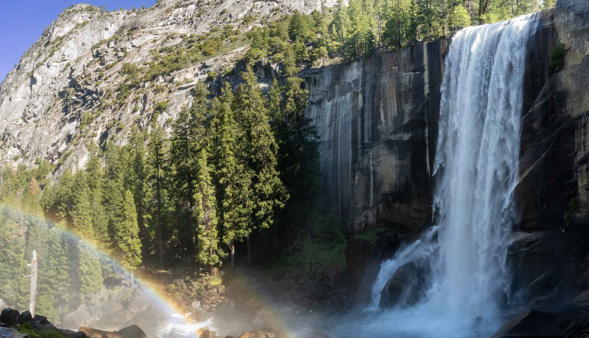
Vernal Falls on the Mist Trail
Max DesMarais is the founder of hikingandfishing.com. He has a passion for the outdoors and making outdoor education and adventure more accessible. Max is a published author for various outdoor adventure, travel, and marketing websites. He is an experienced hiker, backpacker, fly fisherman, backcountry skier, trail runner, and spends his free time in the outdoors. These adventures allow him to test gear, learn new skills, and experience new places so that he can educate others. Max grew up hiking all around New Hampshire and New England. He became obsessed with the New Hampshire mountains, and the NH 48, where he guided hikes and trail runs in the White Mountains. Since moving out west, Max has continued climbed all of the Colorado 14ers, is always testing gear, learning skills, gaining experience, and building his endurance for outdoor sports. You can read more about his experience here: hikingandfishing/about