The Peekaboo Loop Trail is one of the best hiking trails in Bryce Canyon National Park because of its ability to quickly bring hikers through some of the most unique and unforgettable terrain in the country. This trail can be accessed from a few starting points, and here we will provide you with all the information you need to head to Bryce Canyon and complete this hike.
Distance: 5.09 Miles Round Trip (8.19 km)
Elevation Gain: 2,648 feet (807.1 meters)
Difficulty: Intermediate
Duration (Hike Time): 3-4 hours
Trail Options
Peekaboo Loop Trail – From Bryce Point Parking Lot – 5.09 Miles – 2,648 Feet Elevation Gain
This is our recommended path to do this loop, but this can be done from Sunset Point or Sunrise Point as well. It is slightly longer and harder, but we really like the added views. (Explained below)
Hikers begin by descending on beautiful switchbacks on the Peekaboo Loop Connector trail. The trail is extremely easy to follow and well marked. Simply stay on this trail.
1.07 miles into this hike, hikers will reach the Peekaboo Loop Trail. From here, you can choose to hike clockwise or counterclockwise on this route. Both are great, and neither is really any harder or easier, so this is up to you.
The trail is very well marked and easy to follow. Hikers can choose to just do this loop, or add on the hikes that are around sunset and sunrise point. Our favorite approach is to do this loop, then drive on over to sunset point, and do all of the hikes around sunset and sunrise point separately in a second hike.
This trail can get icy, so during winter months, it is recommended to bring microspikes with you to add traction during icy times.
Trail Map
Here we highlighted the route from Bryce Canyon Point Parking Lot:
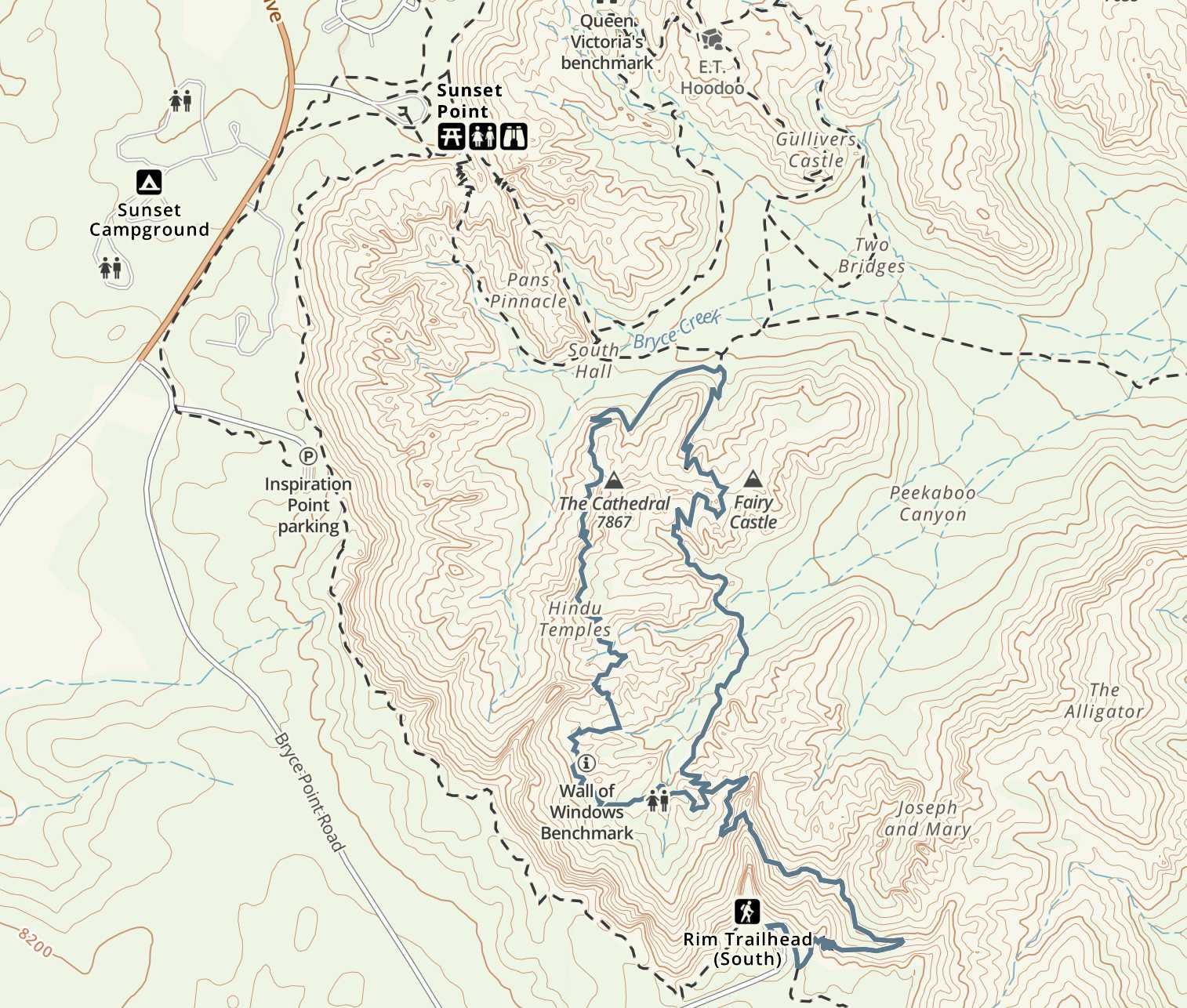
Peekaboo Loop Trail Map – Bryce Canyon National Park
Peekaboo Loop Trail – From Sunset Point – 4.95 Miles – 1,997 Feet Elevation Gain
Leaving from sunset point is your shortest option to complete the Peekaboo loop, and it also gives you really easy access to all of the other best hikes in Bryce Canyon National Park. If you are trying to maximize your speed through the entire park, this is probably a good place to start and finish, (or sunrise point close by).
Hikers start on sunset point, and follow the trail signs to Peekaboo loop. All is well traveled, features many switchbacks, so no areas are too steep. We have highlighted the recommended path for this below. Wall Street isn’t always opened, but you absolutely should take this path whenever it is open. (They close this section during the winter months).
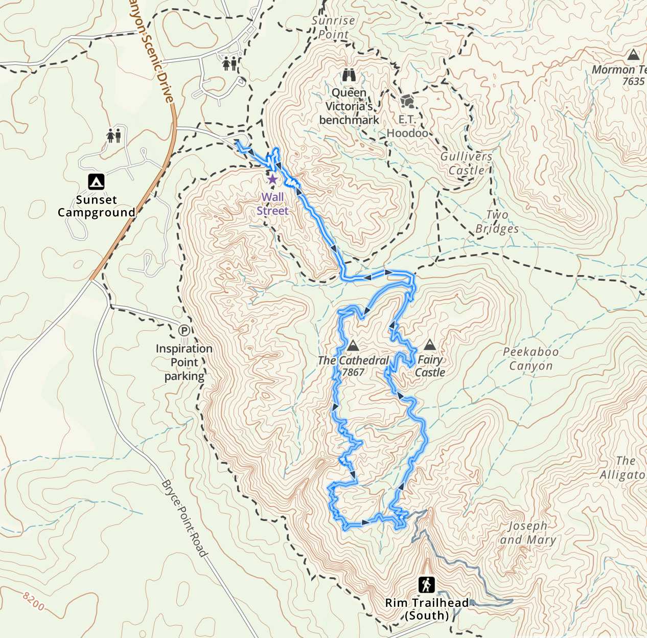
Peekaboo Loop Trail Map – From Sunset Point
Weather Forecast
Here is a detailed weather forecast for the next 4 days:
Tropic, UT
This Afternoon
Mostly cloudy. High near 44, with temperatures falling to around 36 in the afternoon. South southeast wind around 3 mph.
Tonight
Mostly cloudy. Low around 22, with temperatures rising to around 24 overnight. South southwest wind around 3 mph.
Monday
Mostly sunny. High near 45, with temperatures falling to around 37 in the afternoon. South wind around 5 mph.
Monday Night
Partly cloudy, with a low around 21. North northeast wind around 5 mph.
Tuesday
Partly sunny, with a high near 45. East wind around 5 mph.
Tuesday Night
Partly cloudy, with a low around 22.
Wednesday
Sunny, with a high near 47.
Parking, Directions & Shuttle System
All lots in this park are quite large, but they do fill up. During peak time, you’ll be utilizing the shuttle system. During off season, you likely can find a spot to park your car, but even the large lots can fill up.
Shuttle System:
The shuttle system can be read about here: https://www.nps.gov/brca/planyourvisit/shuttle.htm
Directions to Bryce Point Parking Lot:
Directions to Sunset Point Parking Lot:
Additional Pictures
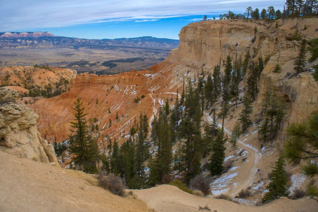
Early On Peekaboo Connector Trail From Bryce Point
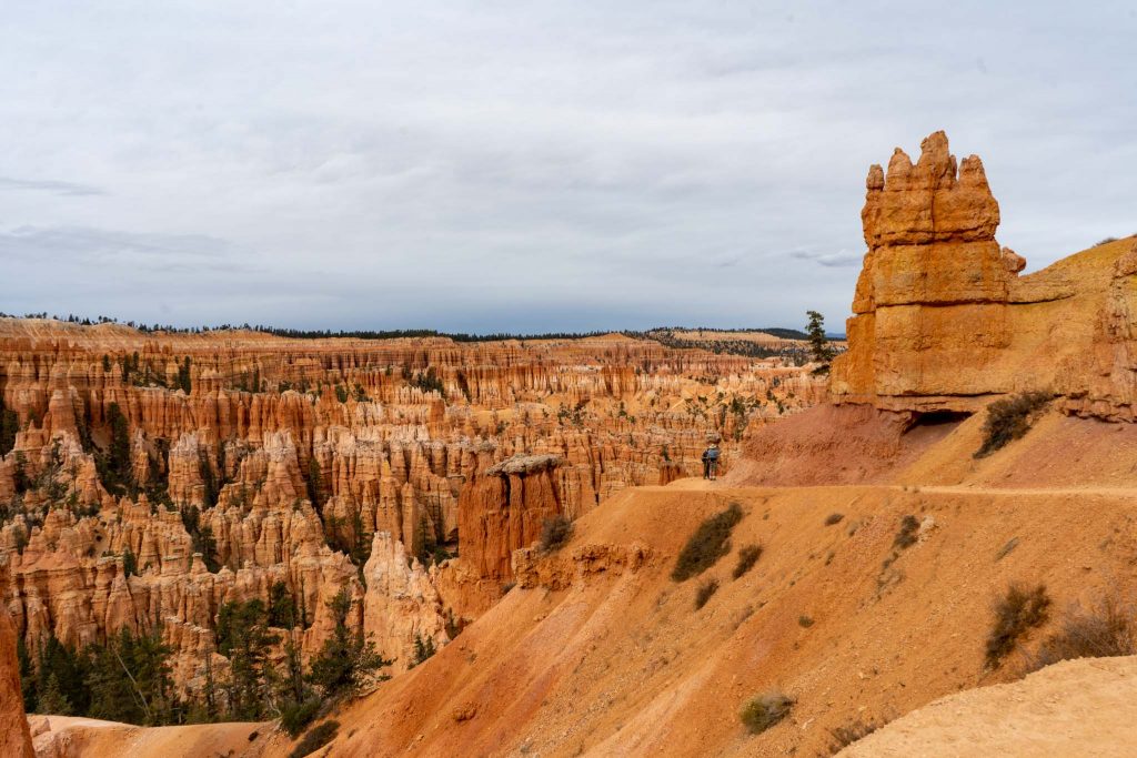
PeekaBoo Loop Trail
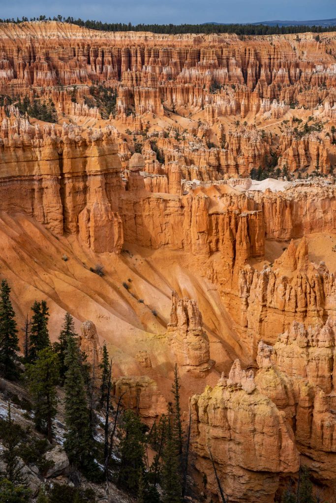
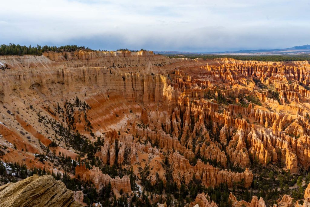
Views of Bryce Canyon Below
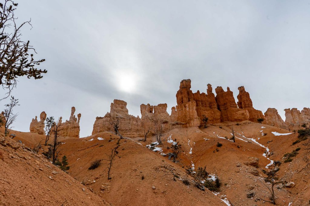
Views Along Peekaboo Loop Trail
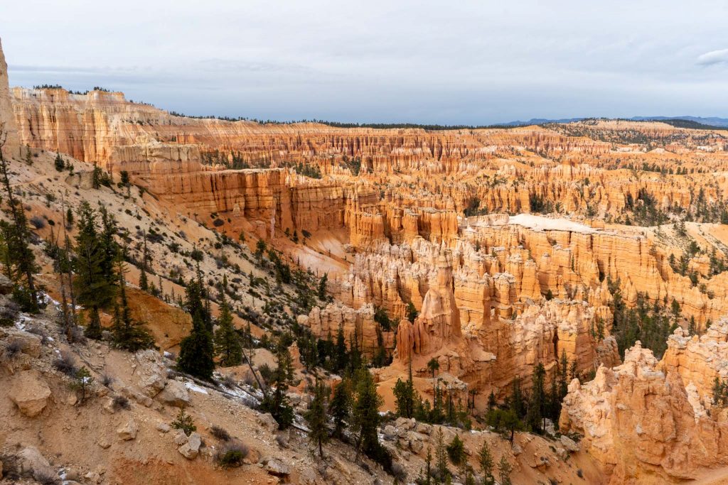
Peekaboo Loop Trail Views
Max DesMarais is the founder of hikingandfishing.com. He has a passion for the outdoors and making outdoor education and adventure more accessible. Max is a published author for various outdoor adventure, travel, and marketing websites. He is an experienced hiker, backpacker, fly fisherman, backcountry skier, trail runner, and spends his free time in the outdoors. These adventures allow him to test gear, learn new skills, and experience new places so that he can educate others. Max grew up hiking all around New Hampshire and New England. He became obsessed with the New Hampshire mountains, and the NH 48, where he guided hikes and trail runs in the White Mountains. Since moving out west, Max has continued climbed all of the Colorado 14ers, is always testing gear, learning skills, gaining experience, and building his endurance for outdoor sports. You can read more about his experience here: hikingandfishing/about
Such Good Conditions For Winter!
Trails in perfect condition without ice or snow, but touches of snow around adding to the views!