Hiking in Chamonix, France, offers an incredible variety of trails that cater to all skill levels, from complete beginners to seasoned mountaineers. The region is famed for its stunning alpine scenery, with routes that showcase the beauty of Mont Blanc, lush valleys, and incredible mountain lakes.
One of the unique aspects of hiking in Chamonix is the availability of cable cars and lifts, such as the Aiguille du Midi and the Brévent-Flégère, which allow hikers to reach high-altitude starting points with ease. This makes it possible for beginners to enjoy stunning panoramic views and moderate hikes without enduring as strenuous climbs. For experienced hikers, backpackers, and trail runners, Chamonix offers challenging trails, like the Tour du Mont Blanc, which provide multi-day trekking experiences through all types of terrain. With well-marked paths, breathtaking landscapes, and convenient lift access, Chamonix is a hiker’s paradise for adventurers of all levels.
Creating This List
This list isn’t an all inclusive list, but they are hikes that I myself have done. My honeymoon featured a 5 night stay in Chamonix, which allowed for tons of exploration in this area, and lots of research to find the best hikes beforehand.
Our aim was to highlight the best hikes within the Chamonix Valley in different categories of difficulty.
Need To Know Information
- For most of these hikes, lifts make the hikes substantially easier than hiking from the valley. We will highlight the statistics for the common routes taken that leverage lifts in the summer. That being said, purchasing lift access will be necessary.
- Chamonix in spring, summer, and fall can experience very large weather changes in just a short lift ride, or just a few hours of time. Hikers need to be prepared with gear for harsh conditions, even when the weather looks clear for a long period of time.
- The typical hiking season for Chamonix is mid-June through mid-September. It is this time of year when the trails are mostly or completely snow free, and the weather often cooperates.
- Dogs are allowed on all public transportation and almost all of the lifts except for Aiguille du Midi. Dogs are not allowed in the nature reserves, so many of the hikes near the lifts are allowed, but extending those hikes often enters nature reserves, and then dogs are not allowed. We recommend going to the visitors center in Chamonix so they can give you a clear map of where dogs are not allowed.
Lift Passes
Chamonix Mont-Blanc has a pass system called the Mont Blanc Multipass. This pass can be purchased for a single day, or several days, and gives users unlimited access to all of the lifts in the Chamonix valley. It pays for itself extremely quickly if visiting for multiple days. It also allows for the most popular locations. We couldn’t recommend grabbing this pass more. It allows for complete freedom in where and when you hike around Chamonix, instead of trying to figure out and purchase single lift tickets.
Best Hikes In Chamonix Map
We created a map with each of the trailhead locations to help you find the best hike. Note that some of these hikes start at the same spot, so we marked each of those starting points with labels for each hike.
Best Chamonix Hikes for Beginners
These easy hikes are great for beginners, families, or anybody who just wants a nice, easy hike in the Chamonix area.
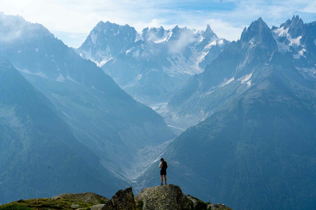
Le Brévent to Refuge de Bellechat
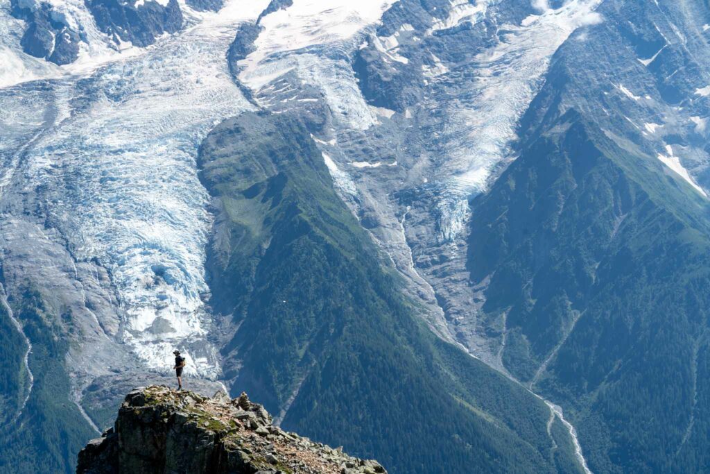
Views from just down the trail from Le Brévent
Le Brévent features an incredible cable car that will take you over sheer cliffs, climbers below, paragliders all around, and unobstructed views of Mont Blanc, Aiguille du Midi, and Chamonix below. The lift to the top itself is worth it where the Panoramic Restaurant sits. No hiking is required to experience incredible views, but we highly recommend dropping down the trail and hiking to Refuge de Bellechat. This short hike will give you some pretty amazing views all around, and take you to an awesome refuge as well.
Hikers do not need to hike all the way to the refuge. A great alternative is to hike to Lac du Brévent, or just to any of the amazing viewpoints of the Chamonix valley.
- Difficulty: Easy
- Distance: 3.28 miles round trip (5.3 km)
- Height: 8,219 feet (2505 m)
- Elevation gain: 1,477 feet (450.2 meters)
- Duration: 2-3 hours
- Hike Map
- Directions: Cable Car Location
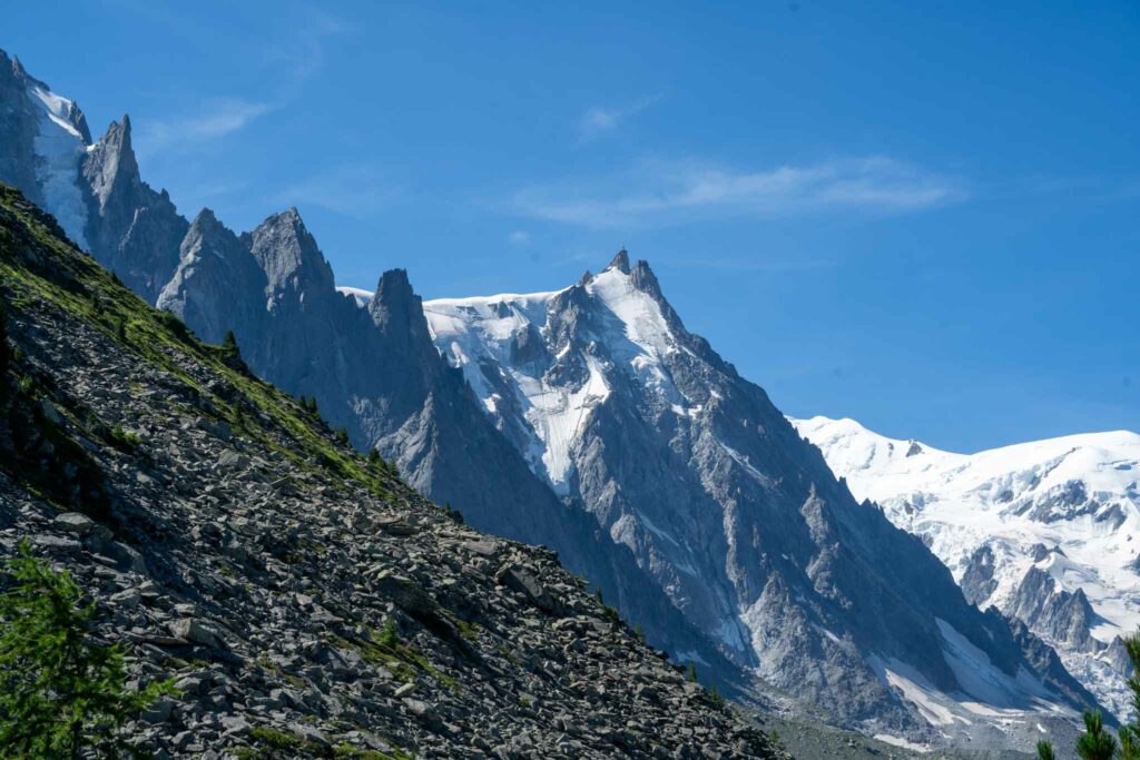
Aiguille du Midi
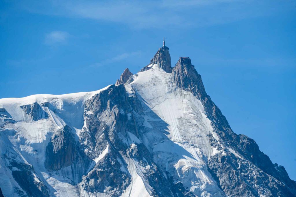
Aiguille du Midi isn’t really a hike, but we wanted to add it to the easy hikes list as this should be on everyone’s must do list for visiting Chamonix. A great idea is to take the cable car to the top, and enjoy walking around all of the buildings and viewpoints at the summit. Experienced mountaineers can choose to start a hike from the top with the proper glacial travel equipment. There are hundreds of destinations from this point, including Mont Blanc.
In addition, we recommend on the way down, exploring around the mid station lift, and visiting the Refuge du plan de l’aiguille as it was our favorite refuge with some of the best food we have had for very reasonable prices. On top of that, you get to watch cable cars passing, and have perfect views of the Glacier des Bossons.
- Difficulty: Easy
- Height: 12,605 ft (3,842 meters)
- Elevation gain: NA
- Duration: NA
- Dogs: Not allowed
Lac Bleu & Refuge du plan de l’aiguill Loop
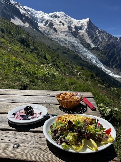
Omelette, Salad, Bread, and Pie at Refuge du plan de l’aiguil
Lac Bleu is a fantastic hike to add on to your mid station stop on the way back from Aiguille du Midi. The lake sits below some incredible cliffs and is nice and easy to get to. We recommend combining Lac Bleu with a visit to Refuge du plan de l’aiguill for some delicious food with insane views.
We created a loop map via the link below.
- Difficulty: Easy
- Distance: 1.73 miles (2.8 km)
- Elevation gain: 730 feet (223 meters)
- Duration: 1-2 hours
- Dogs: Not Allowed
- Map of Hike
- Directions: Lower Cable Car
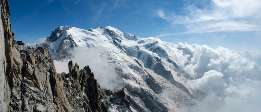
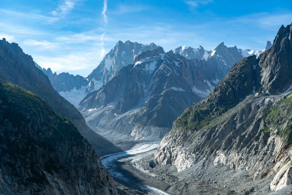
Mer de Glace
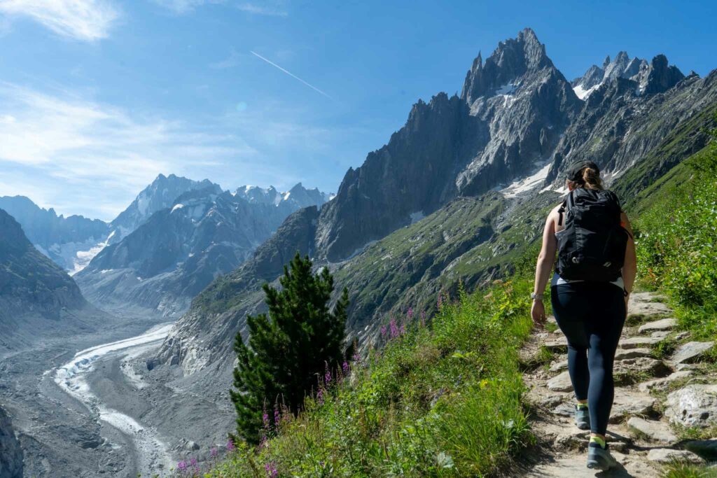
Mer De Glace views from the beginning of the Grand Balcon Nord trail
Mer de Glace is accessed via the Montenvers Mer de Glace train. This train is also part of the Mont Blanc Multipass, and your time on the train must be reserved using that pass. The train ride itself is beautiful, and then, you take a cable car down to the glacier where there is a glacial tunnel for visitors to walk through.
Glacier guided tours leave from this area, and we also recommend this to be a part of one of our intermediate to advanced hikes on this list, the Grand Balcon Nord. We wanted to put this area on the easy hikes list, as a great alternative to the entire Grand Balcon Nord trail is to simply go down to the glacier, and head up the Grand Balcon Nord trail to see the overlook above the glacier and the valley below.
- Difficulty: Easy
- Distance: 1 mile round trip
- Elevation gain: 600 feet
- Duration: 1 hour
- Dogs: Allowed
- Directions: To Montenvers Train Station
Intermediate & Hard Hikes
Grand Balcon Nord
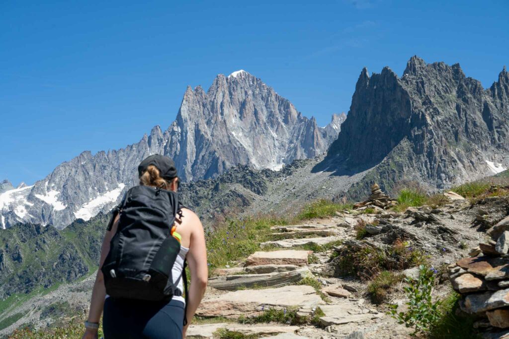
Grand Balcon Nord trail
The Grand Balcon Nord Trail connects Top of the Montenvers train station at Mer De Glace to Plan de l’Aiguille. This is the mid station of Aiguille du Midi. This trail gives hikers incredible views of the Mer De Glace and surrounding peaks, Chamonix Valley, and so much more. If I had to pick one hike to combine some of the best views in all of the valley, this would be at the top of the list.
Mer De Glace from Grand Balcon Nord
This can be hiked in either direction, from Montenvers, or from Plan de l’Aiguille. From Plan de l’Aiguille is more common because it involves much less elevation gain than from Montenvers. Both directions are beautiful. It is far less busy to start in the morning on the Montenvers side since most people will start on the other side to avoid the elevation gain.
Aiguille du Midi from the Grand Balcon Nord
Once again, lifts are needed to keep this hike short. Without lifts, it because quite a large day. Hikers need the Mont Blanc Multipass, and to reserve the Montenvers trail, and the Plan de l’Aiguille, or they need to purchase one way tickets for both.
- Distance – 3.71 miles round trip (5.97 km)
- Elevation Gain From Montenvers – 2,305 feet (703 meters)
- Elevation Gain From Plan de l’Aiguille – 976 feet (297 meters)
- Duration – 2 – 4 hours
- Difficulty – Intermediate to Difficult
- Dogs: Not Allowed
- Link To Trail Map
- Directions: To Montenvers Train Station | To Lower Cable Car
Lac Blanc

It you look up an article on the best hikes in Chamonix, you’ll find Lac Blanc, and for good reason. Lac Blanc itself is stunning, but it is the trail to the lake that is the best part. This hike features some of the best views of Chamonix valley and the surrounding peaks, a high likelihood of seeing mountain goats, a stunning lake, and an awesome refuge right at the lake.
This hike is accessed from the Station La Flégère, and can be accessed from various other areas as well.
An overlook on the trail to Lac Blanc
Another unique way to add to this hike, is to leverage the Index lift and hike from the top of that lift over to Lac Blanc.
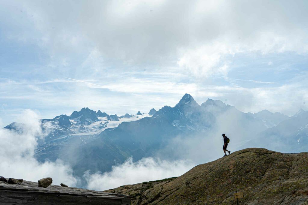
Photo taken from the Lac Blanc Refuge
- Difficulty: Intermediate
- Distance: 3.96 miles round trip (6.4 km)
- Elevation Gain: 1,848 feet (563.27 m)
- Duration: 3-4 hours
- Link To Trail Map
- Directions: To Station La Flégère
La Jonction
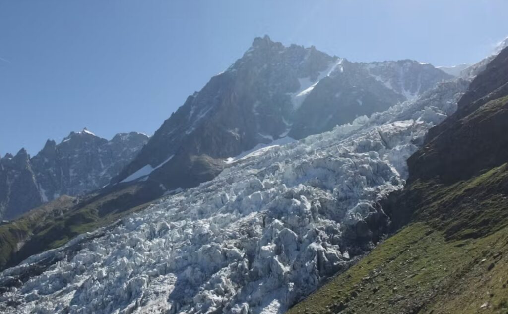
La Jonction views of Aiguille du Midi
La Jonction is an awesome hike that gets hikers right up against Glacier des Bossons, and past two chalets with stunning views. This hike can be done from the valley, or can be shortened via one of the more inexpensive lifts in the valley. The Glacier des Bossoms lift takes hikers up about 400 meters to the Glacier des Bossons chalet. From here, hikers continue on the trail to Le Jonction through a well marked, well traveled, and switchback filled trail.
Hikers will eventually pass Chalet des Pyramids (a great drink and food spot) before continuing along towards Le Jonction. The views are incredible. This is a challenging hike, and even more challenging without hte 400 meters gained from the chairlift, but the unique views of the glacier are well worth it.
Hikers do not need to hike all the way to La Jonction. There are various viewpoints that make this hike worth it before, but we do recommend the full experience if you can handle 4000+ feet of vertical gain.
- Difficulty: Difficult
- Distance: 5-7.5 miles (8-12 km)
- Elevation gain: 4,000-5,000 feet (1,219 – 1,524 m)
- Duration: 6-9 hours
- Link To Trail Map
Max DesMarais is the founder of hikingandfishing.com. He has a passion for the outdoors and making outdoor education and adventure more accessible. Max is a published author for various outdoor adventure, travel, and marketing websites. He is an experienced hiker, backpacker, fly fisherman, backcountry skier, trail runner, and spends his free time in the outdoors. These adventures allow him to test gear, learn new skills, and experience new places so that he can educate others. Max grew up hiking all around New Hampshire and New England. He became obsessed with the New Hampshire mountains, and the NH 48, where he guided hikes and trail runs in the White Mountains. Since moving out west, Max has continued climbed all of the Colorado 14ers, is always testing gear, learning skills, gaining experience, and building his endurance for outdoor sports. You can read more about his experience here: hikingandfishing/about