Mount Cameron is an CO 14er on the unofficial list. The summit rises above 14,000 feet making it one of the CO 58. Cameron is often hiked during a loop hike known as the Decalibron, that is combined with Mount Bross, Mount Lincoln, and Mount Democrat.
Height – 14,238 feet (4,353.46 m)
Distance – 4.6 miles round trip (7.4 km)
Elevation gain – 2,208 feet (673.0 m)
Duration – 2 to 4 hours (book time)
Difficulty – Intermediate
Hike Class: Class 2
Seasons – Year-round (caution and experience needed in winter – see below)
Trailhead Location – Kite Lake – 12,030 feet (directions below)
***IMPORTANT NOTE***
– The summit of Mount Bross and Mount Lincoln closed to the public. Read about this here: https://www.14ers.org/peaks/mosquito-range/mount-bross/
Trail Map
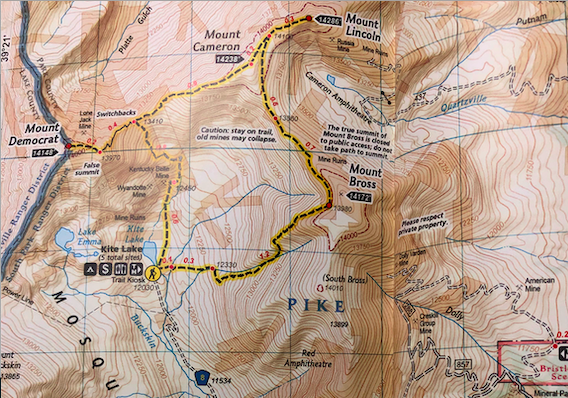
Trails
KITE LAKE TRAIL TOWARDS MOUNT CAMERON: 4.6 MILES ROUND TRIP | 2,208 FEET ELEVATION GAIN
This is the most common route to the summit of Cameron. Most hikers do not just do this out and back. They summit all of the mountains as a loop. To read more about that, check out our post on the Decalibron.
KITE LAKE TO MOUNT BROSS: 6.2 MILES ROUND TRIP | 2,548 FEET ELEVATION GAIN
This route begins at the same starting location, but hikers will head up towards Mount Bross first. This trail begins relatively flat before hitting the rock/scree fields below Mount Bross. Quickly, this route gets very steep with lots of loose rock and gravel. Extra caution should be taken on this path due to the trail conditions and loose rock. Once hikers ascend to above the steep grade, the hike over to the Mount Lincoln and Mount Cameron split is relatively simple. Hikers are urged to stay on trail due to the dangers of old mines, as well as private property concerns. The summit of Mount Bross is currently considered closed due to private property reasons.
Hiking in Winter
Mount Cameron can be hiked in winter months. Caution should be taken due to Avalanche risks. Hikers should be fully prepared and experienced winter hikers.
Camping Information
There are 5 tent sites available at the Kite Lake Campground. It also features toilets, parking at trailhead, and picnic tables. No water is available. The camping fee is $12. Information on camping can be found here. Kite lake is frequently fished.
Current Weather Conditions
Here is a detailed forecast for the next 4 days:
Alma, CO
This Afternoon
Sunny, with a high near 20. Wind chill values as low as 0. West northwest wind around 15 mph.
Tonight
Mostly clear, with a low around 8. Wind chill values as low as -6. West northwest wind 10 to 15 mph.
Monday
Sunny, with a high near 23. Wind chill values as low as -6. West northwest wind 5 to 15 mph.
Monday Night
Mostly clear, with a low around 9. Wind chill values as low as -6. West northwest wind around 10 mph.
Tuesday
Sunny, with a high near 26. Northwest wind around 10 mph.
Tuesday Night
Partly cloudy, with a low around 9. Northwest wind 10 to 15 mph.
Wednesday
Sunny, with a high near 23. West northwest wind 5 to 15 mph.
Directions & Parking
Parking at the trailhead is $3 per day and done via self service.
The road to the trailhead starts in Alma, and one can reach there by taking one of the following routes:
- Colorado 9 to Alma
- Highway 285 to Fair play and then Highway 9 to Alma
- Highway 9 exit (exit 203) off of the I-70 via Breckenridge
As soon as you reach Alma, look for a sign for the road to Kite Lake. The sign is located in the middle of the town on the west side of the road. You will have to cross some residential area after this sign. As your vehicle gets closer to Kite Lake, the road conditions worsen, and the last mile is the worst. A good vehicle with wide clearance will, however, make it simple for you. 4WD recommended. If you don’t have a capable vehicle, you may see yourself adding mileage by having to park far down the road.
Additional Pictures
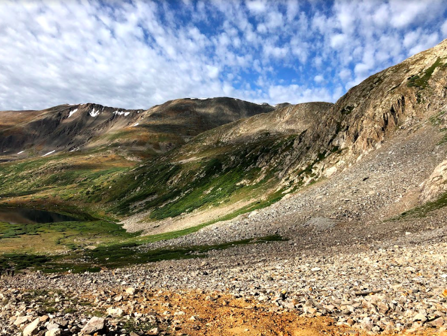
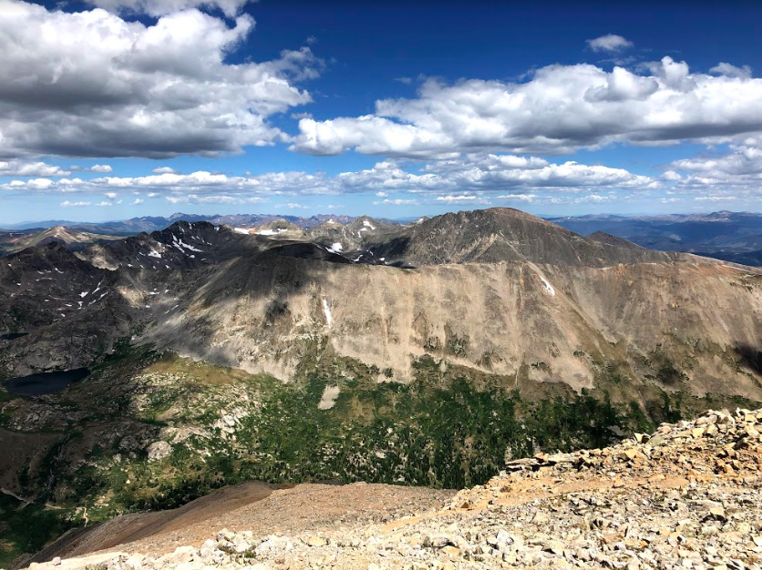
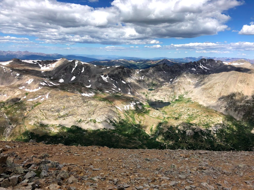
Looking back at Kite Lake
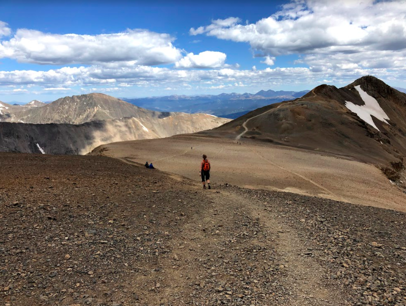
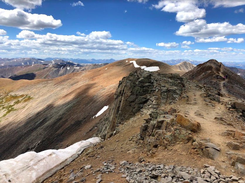
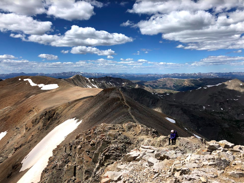
Heading to Lincoln from Mount Cameron
Lincoln from Mount Democrat Summit
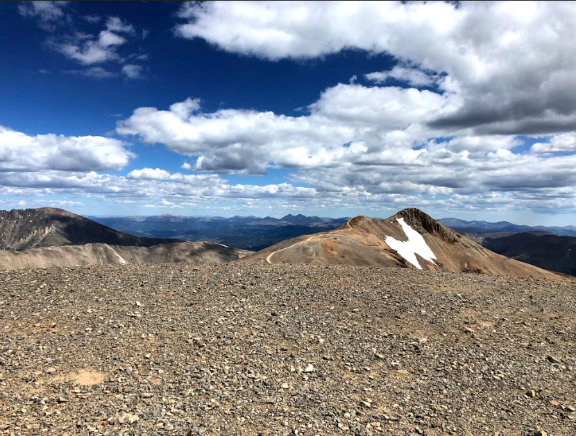
Mount Lincoln Looking Towards Quandary Peak
Mount Lincoln Summit
Mount Lincoln Summit Views
Mount Lincoln Summit Views
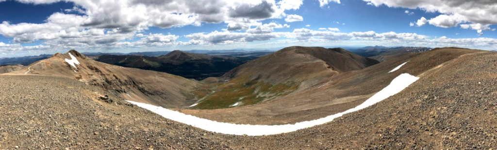
Views of Lincoln and Bross from Cameron
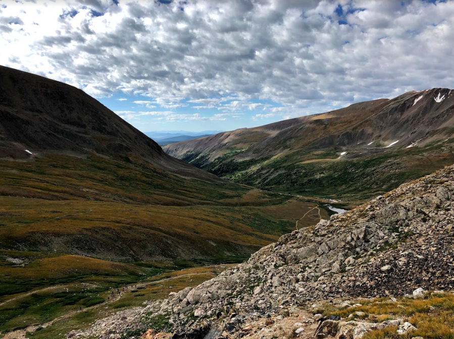
The Connection Between Mount Democrat and Mount Cameron
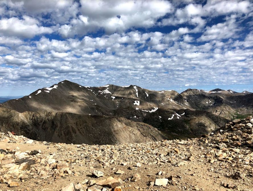
Views from Early on in Hike
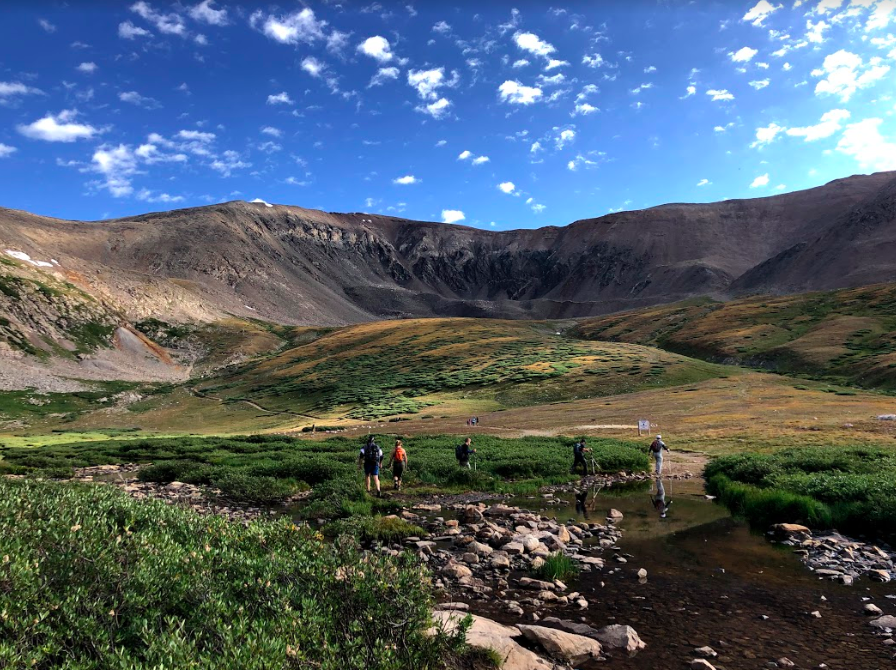
Views of Kite Lake While Ascending Mount Democrat
Max DesMarais is the founder of hikingandfishing.com. He has a passion for the outdoors and making outdoor education and adventure more accessible. Max is a published author for various outdoor adventure, travel, and marketing websites. He is an experienced hiker, backpacker, fly fisherman, backcountry skier, trail runner, and spends his free time in the outdoors. These adventures allow him to test gear, learn new skills, and experience new places so that he can educate others. Max grew up hiking all around New Hampshire and New England. He became obsessed with the New Hampshire mountains, and the NH 48, where he guided hikes and trail runs in the White Mountains. Since moving out west, Max has continued climbed all of the Colorado 14ers, is always testing gear, learning skills, gaining experience, and building his endurance for outdoor sports. You can read more about his experience here: hikingandfishing/about