Mount Sherman is known as one of the easiest Colorado 14er hikes due to the short mileage and high elevation trailhead. It features various mine shafts, stunning views, and access to some fantastic 13er peaks.
Quick Navigation:
Trail Map | Trails | Winter | Directions | Weather | Pictures
Difficulty – Intermediate
Distance – 4.6 miles miles round trip (7.40 km)
Height – 14,036 feet (4,278.2 meters)
Elevation gain – 2,150 feet (655.3 meters)
Duration – 3 to 5 hours (book time)
Hike Class: Class 2
Seasons – Year-round (caution and experience needed in winter – see below)
Trailhead Location – Fourmile Creek Trailhead (Alternate: Iowa Gulch)
Trail Map
Mount Sherman Trail Map
Trails
Fourmile Creek Trailhead (4wd) | 4.6 Miles Round Trip | 2,150 Feet Elevation Gain | Class 2
This is the most common route up Sherman (directions below). The road to to the trailhead is dirt, but manageable by most vehicles. The trail begins along a dirt road and gradually gains elevation for .3 miles before reaching the first mine.
.5 miles in, hikers will reach a junction where roads/paths continue to other mines, and to the right, the trail continues. The trail can be difficult to follow given all of the various walking paths around the mines. Hikers should attempt to stay on the most traveled trail, though it is very easy to get off the trail, it is pretty easy to simply find your way back to the trail, or continue on to your destination by site.
1.2 miles in, hikers will reach Hilltop Mine. This mine features gorgeous views of Mount Sherman and the other surrounding peaks. From here, hikers can see the entire trail to the summit.
1.4 miles in, hikers will reach the saddle between Mount Sheridan and Mount Sherman. From here, the summit is .9 miles of solid elevation gain, but the views in all directions are fantastic. Hikers will reach the summit 2.3 miles in and can retrace their steps back to the trailhead.
Fourmile Creek Trailhead (2wd / Winter) | 8.4 Miles Round Trip | 2,820 Feet Elevation Gain | Class 2
This is the exact same route as above, but if you have a low clearance 2WD vehicle in summer, or during winter months when the road closes before the upper trailhead, hikers will need to hike along the road an additional 1.9 miles each way.
Iowa Gulch | 4.6 Miles Round Trip | 2,150 Feet Elevation Gain | Class 2
This trailhead starts at 11,900 feet, and is the less traveled route to the summit. This is an unmarked trailhead located, so you will have to spot the trail visually.
Hikers begin heading southeast from the road across a meadow for 0.5 miles. The direction is towards the saddle between Mount Sheridan and Mount Sherman. Hikers will see a rubble field without much trail. Here, they should choose the best path for them through these rocks, but should stay north (left) of the main drainage creek. After connecting with the drainage and heading up stream, hikers should be able to find the trail by sight a little bit easier all the way up to the saddle.
Hikers should stay on the trail heading towards the saddle between both peaks. Follow the trail for .9 miles to the summit.
Hiking in Winter
Mount Sherman is a common winter hike. The winter months add miles to all routes due to road closures, so extra time needs to be allocated due to this. Both starting locations have areas of avalanche risk, making it essential for hikers to know the risks, and assess the current situation.
From Fourmile creek, the winter route breaks from the standard route by heading up the south slopes of the mountain with a more direct route to the summit. Even this route has some avalanche danger. We recommend checking out the 14er winter description for this route: https://www.14ers.com/route.php?route=sher3&peak=Mt.+Sherman
Directions & Parking
Below are directions for both routes – to the upper trailheads of each, 4wd is highly recommended, and winter, the upper trailheads are inaccessible due to road closures.
Fourmile Creek Trailhead
To Iowa gulch Trailhead
Current Weather Conditions
Here is a detailed forecast for the next 4 days. Check Mountain Forecast beforehand.
Leadville, CO
Overnight
Areas of blowing snow. Clear, with a low around 9. Wind chill values as low as -14. West northwest wind 25 to 30 mph, with gusts as high as 50 mph.
Sunday
Patchy blowing snow before 11am. Sunny, with a high near 22. Wind chill values as low as -10. West northwest wind 10 to 25 mph, with gusts as high as 40 mph.
Sunday Night
Mostly clear, with a low around 9. Wind chill values as low as -10. West northwest wind 15 to 20 mph.
Monday
Sunny, with a high near 24. Wind chill values as low as -9. West northwest wind 10 to 20 mph.
Monday Night
Mostly clear, with a low around 9. Northwest wind 10 to 20 mph.
Tuesday
Sunny, with a high near 25. Northwest wind 10 to 15 mph.
Tuesday Night
Mostly clear, with a low around 11. Northwest wind 10 to 20 mph.
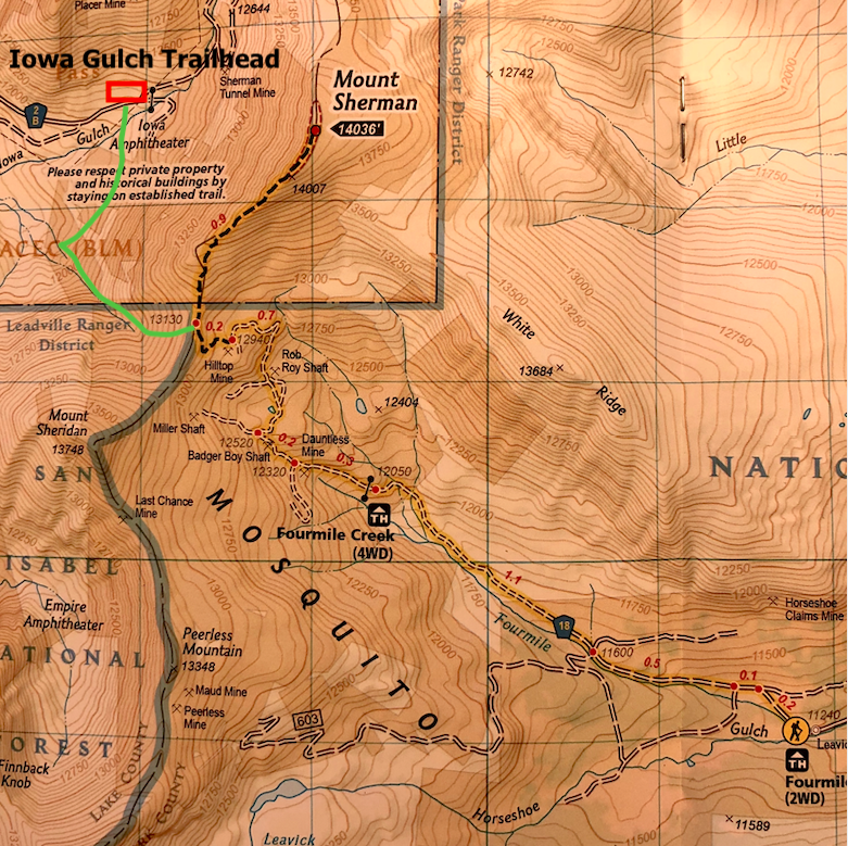
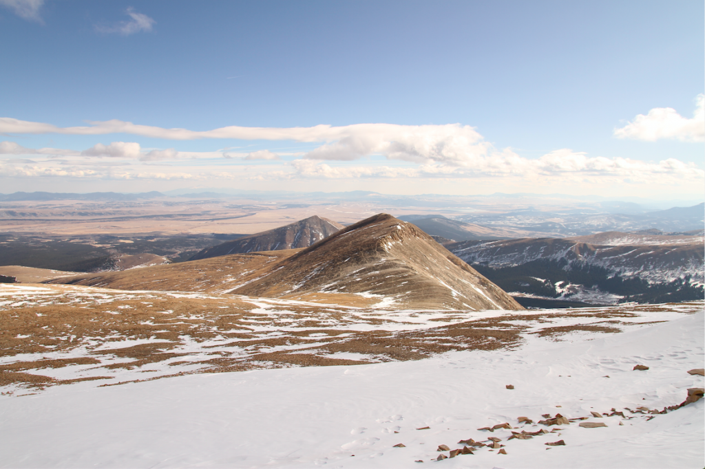
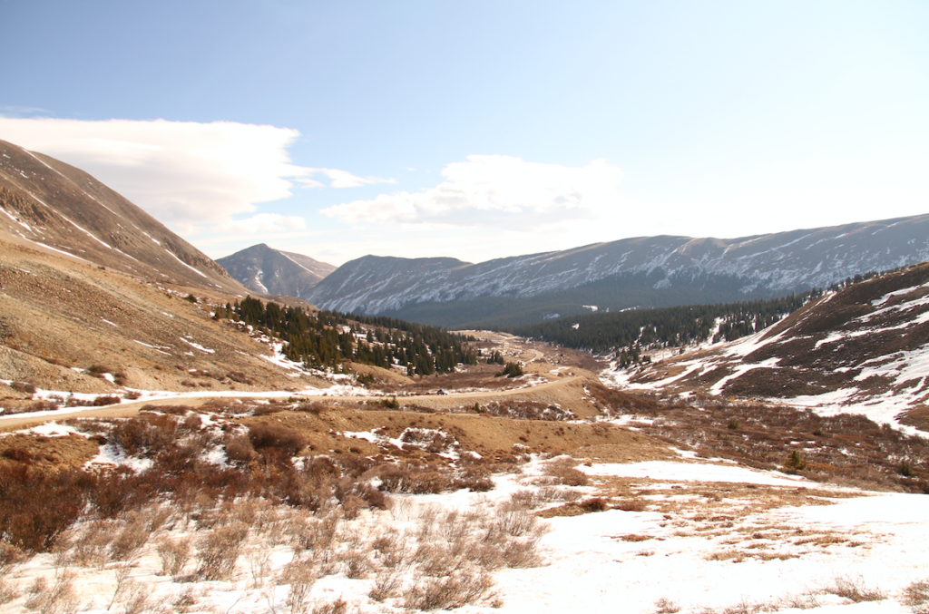
Additional Pictures
White Ridge from Mount Sherman
Fourmile Creek Road
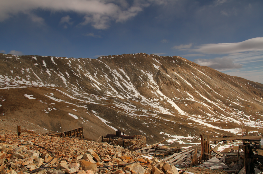
Hilltop Mine & White Ridge
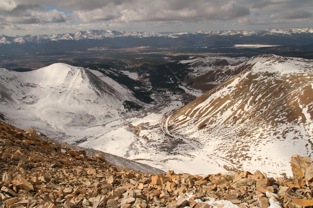
Views into Iowa Gulch from Sherman Summit
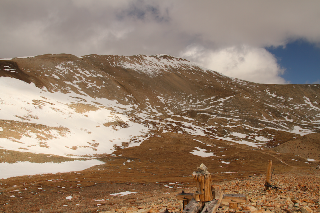
Mount Sherman Summit from Hilltop Mine
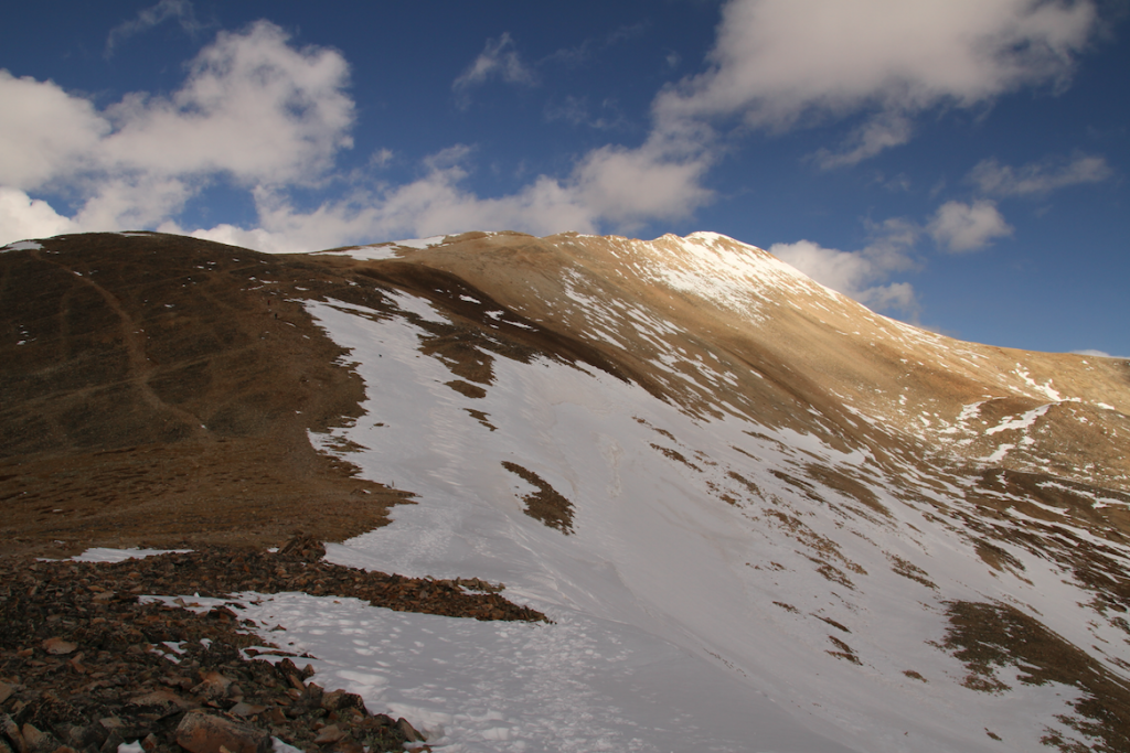
Mount Sherman from the Saddle between Sherman and Mount Sheridan
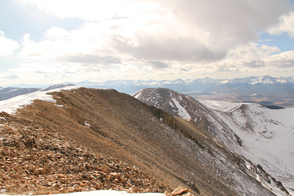
Mount Sheridan from Mount Sherman Summit
Max DesMarais is the founder of hikingandfishing.com. He has a passion for the outdoors and making outdoor education and adventure more accessible. Max is a published author for various outdoor adventure, travel, and marketing websites. He is an experienced hiker, backpacker, fly fisherman, backcountry skier, trail runner, and spends his free time in the outdoors. These adventures allow him to test gear, learn new skills, and experience new places so that he can educate others. Max grew up hiking all around New Hampshire and New England. He became obsessed with the New Hampshire mountains, and the NH 48, where he guided hikes and trail runs in the White Mountains. Since moving out west, Max has continued climbed all of the Colorado 14ers, is always testing gear, learning skills, gaining experience, and building his endurance for outdoor sports. You can read more about his experience here: hikingandfishing/about