Mount Monroe is a 5,372 foot mountain in the Presidential Range in the White Mountains of New Hampshire. It is the 4th highest mountain on the official NH 48 4,000 footers list of New Hampshire. The highlighted route for Mount Monroe passes by the Lakes of the Clouds Hut. The exposed, rugged summit offers panoramic views of Mount Washington and rest of the Presidential Range. This mountain is often paired with Mount Washington, looping back down to the Cog Railway parking area by taking the Jewell trail after reaching Washingtons summit.
Elevation: 5,372 feet (1,637 meters)
Elevation Gain: 2,824 feet
Distance: 7 miles roundtrip
Difficulty: Strenuous
Duration (book time): 5 hours
Trails
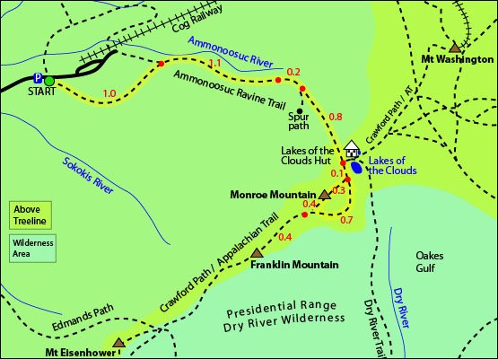
Ammonoosuc Ravine Trail
The most common way to summit Mount Monroe is by taking the Ammonoosuc Ravine trail, located off of Base Road in Thompson and Meserve’s Purchase, NH. Begin hiking on the Ammonoosuc Ravine trail where the first mile or so will be rather flat and rocky. You will then reach a junction with a 0.3 mile trail leading to Base Station, keep right and continue on the Ammonoosuc Ravine Trail for another 1.1 miles until you reach the Gem Pool and its waterfall. After crossing over the falls, the trail begins to steeply climb for 0.8 miles until you reach the Lakes of the Clouds Hut and the junction for the Crawford Path, also part of the Appalachian Trail. At the junction, follow the Crawford Path for 0.1 miles and then follow along the Mount Monroe Loop to the summit. The summit of Mount Monroe is only 0.3 miles from there. After summiting, you can descend either side of the loop trail back to the hut.
Trail Map
Nearby Hikes – Monroe and Washington Loop
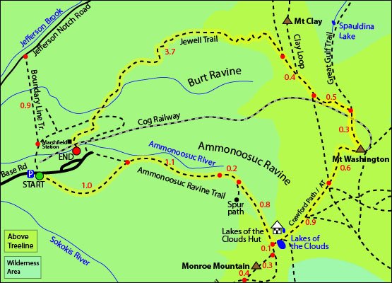
Mount Monroe is often paired with its Northern neighbor, Mount Washington as a loop hike. Hikers will start at the Ammonoosuc Ravine trailhead and climb up to the summit of Monroe. After summiting Monroe, you will then hike back down to the Lakes of the Clouds Hut and continue along the Crawford Path(AT) until you reach the summit of Washington at 6,288′. To descend, you will follow the Great Gulf Trail from the summit for roughly 0.3 miles until you reach the Jewell Trail junction. Continue for another 0.5 miles until you reach a junction with the West Side Trail. Here, continue straight for 0.4 miles until you reach another junction with the Jewell trail. Here, you will stay left and follow the Jewell trail for 3.7 miles until you reach the parking lot.
Distance: 10.2 miles roundtrip
Elevation gain: 3,800 feet
Duration (book time): 6-8 hours
Difficulty: Strenuous
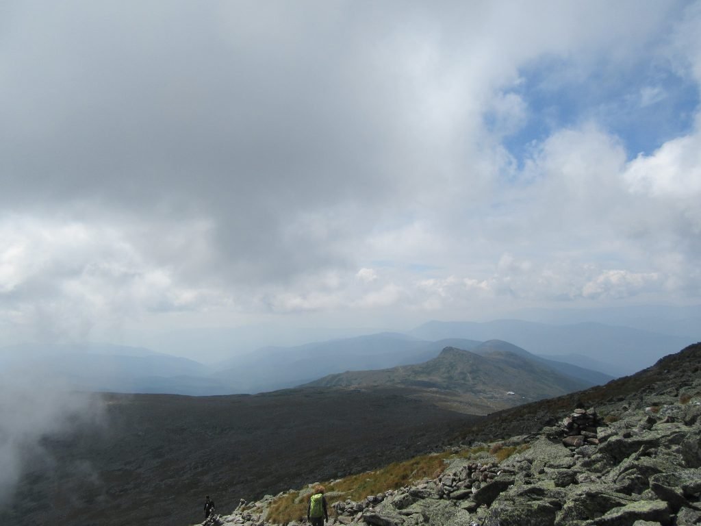
Photo credit – Whit Andrews
Hiking in Winter
Winter hiking in the White Mountains requires specialized gear and skills. Please note that the weather on Monroe is similar to Mount Washington, its Northernmost neighbor. The extreme weather conditions in the alpine zone poses a major risk not only during the winter, but all year long. Note: The Lakes of The Clouds Hut is not open to hikers in the winter. It is boarded up and there is no caretaker available. There is a trap door located towards the back side of the hut that remains unlocked year round and serves as an emergency shelter for hikers in case of extreme weather conditions. Before heading out, always be sure to check the higher summits forecast on the Mount Washington Observatory website.
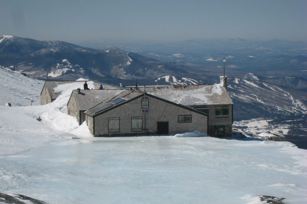
Photo credit – Doug Letterman
Camping and Overnight Hiking Options
The entire trail is amongst a USFS “Forest Protection Area”. There is no camping allowed within 200 feet of the trail. The Lakes of the Clouds Hut offers a reservation based overnight option for hikers to sleep, enjoy a meal, and hit the trails early. The hut operates seasonally, and there is no caretaker on duty or services provided during the off season. There is a small refuge room that is kept unlocked during the winter to provide an emergency shelter for hikers. It is located on the bottom left side of the building, if you are facing up the mountain.
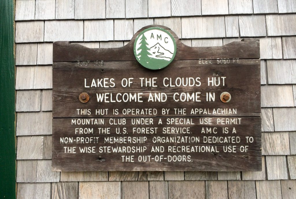
Photo credit – Wesley Carr
Parking
The Ammonoosuc Ravine Trailhead parking area is located off Base Station Road in Thompson and Meserve’s Purchase, NH.
Directions
To get to the Ammonoosuc Ravine trailhead
From the junction of Route 3 and Route 302: Go East on Route 302 for roughly 5 miles. Make a left turn onto Base Station Road, where you will see a billboard sign for the Mount Washington Cog Railway. Drive for about 5 miles on Base Station Road until you reach the WMNF parking area on the right. The parking area is large and can fit many vehicles.
Weather
The short but steep climb from the Lakes of the Clouds is entirely above treeline and exposed to the elements. Sustained winds of over 100 miles per hour, freezing temperatures, and snow is likely to occur during any month of the year. Prepare and plan accordingly. Since the last segment of the trail is exposed, do not attempt in inclement weather with low visibility.
Gorham, NH
Additional photos
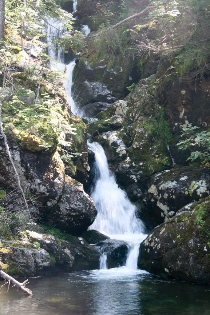
Photo credit – Tim Sackton
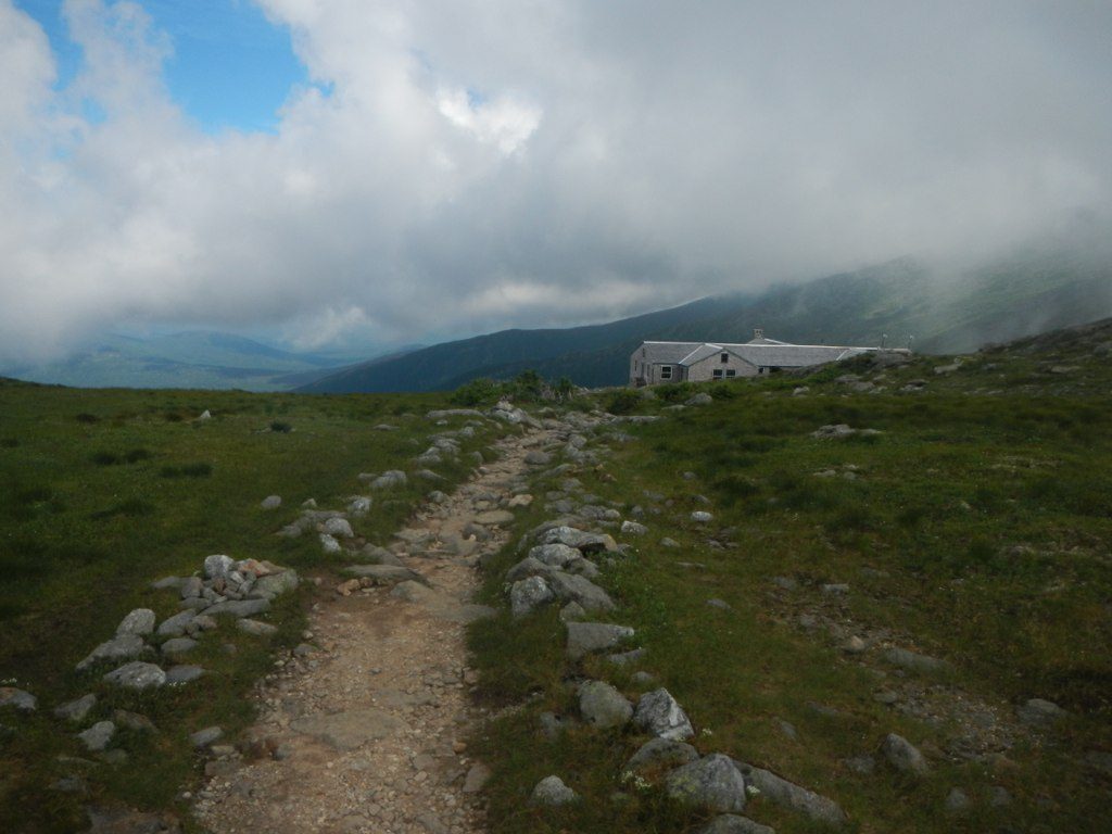
Photo credit – John Hayes