Mount Isolation has earned its name for a reason. Nestled in the middle of the Dry River Wilderness, it truly is isolated from manmade things, as well as heavy foot traffic. The hike is difficult, but the views are gorgeous, the chances of seeing moose are high, and of course, it is just over 4,000 feet!
Height: 4,004 feet (1,220 Meters)
Distance: 12-19.6 miles (See Options Below)
Elevation Gain: 4,000-5,000 (See Options Below)
Duration: 7-10 hours
Difficulty: Very Strenuous
Trail Map
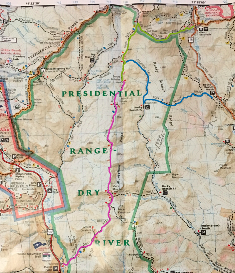
Click Below Image for Full Map
Trails
Rocky Branch Trail – Isolation Trail – Davis Path | 14.6 Miles | 3,600 Feet Elevation Gain
The trailhead for this route is located just off of NH 16. This is the most common route to Isolation. Despite the long length, this option features a relatively gradual gain (except for the beginning of the hike). Isolation is very difficult for its size as it makes hikers gain and lose elevation no matter what path they take.
Glen Boulder Trail – Davis Path | 12 Miles | 5,050 Feet Elevation Gain
This in my opinion, is the best route to Isolation. Starting of Route 16 at the Glen Ellis Falls parking area, it ascends quickly above treeline to incredible views of Pinkham Notch, the Wildcats, the Carters, and the precariously placed Glen Boulder. This route features heavy elevation gain as you ascend to Boott Spur (above 5,000 feet) and descend back down, to then rise up again to the summit of Isolation. On top of the ridge here, you get incredible views into the Dry River Wilderness. It is the path from Boot Spur to Isolation in which you will find many moose tracks, and may end up coming across one (see embedded video). Be sure to check out Glen Ellis falls before you leave!
Davis Path | 19.6 Miles | 4,050 Feet Elevation Gain
Davis path begins at a large parking area off of US 302 a few miles south of Crawford Notch. This trail up the mountain features incredible views, lots of vertical gain and loss, and passes only .5 miles away from the gorgeous summit of Mount Crawford.
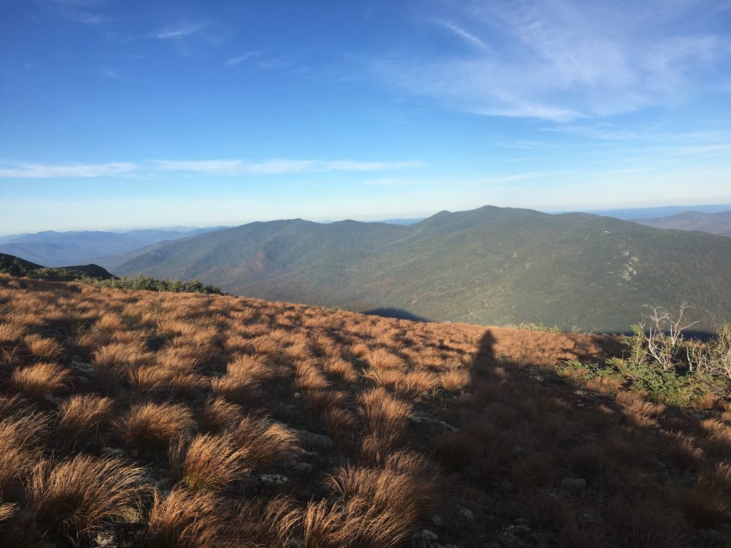
Summit Views
The views from the summit of Isolation are spectacular. A large rock face gives hikers clear and expansive views of Mount Washington, Boot Spur, Mount Monroe, and many other mountains.
Winter Hiking
Isolation is one of the more difficult winter hikes. The Glen Boulder trail is extremely steep, and hikers get exposed to high winds and snowdrifts from the ridge to Boott Spur. Davis Path and the Rocky Branch path are likely better options, but it is important for hikers to understand the difficulty of breaking trail during the winter time. It makes these already long trails, far longer. These trails being less traveled, it is often easy to lose trail, so it is only recommended in the winter by those that can navigate very well with map and compass.
Weather Forecast
Bartlett, NH
This Afternoon
Isolated snow showers. Mostly sunny, with a high near 20. Wind chill values as low as -1. West wind around 15 mph, with gusts as high as 30 mph.
Tonight
Isolated snow showers after 2am. Partly cloudy, with a low around 10. Wind chill values as low as -6. Northwest wind 15 to 20 mph, with gusts as high as 35 mph.
Monday
Isolated snow showers. Mostly sunny, with a high near 16. Wind chill values as low as -8. Northwest wind around 15 mph, with gusts as high as 30 mph.
Monday Night
Isolated snow showers. Mostly cloudy, with a low around 11. Wind chill values as low as -6. Northwest wind around 15 mph, with gusts as high as 35 mph.
Tuesday
Isolated snow showers. Partly sunny, with a high near 18. Northwest wind 10 to 15 mph, with gusts as high as 25 mph. New snow accumulation of less than half an inch possible.
Tuesday Night
Mostly cloudy, with a low around 10. New snow accumulation of less than half an inch possible.
Wednesday
Isolated snow showers after 1pm. Partly sunny, with a high near 20.
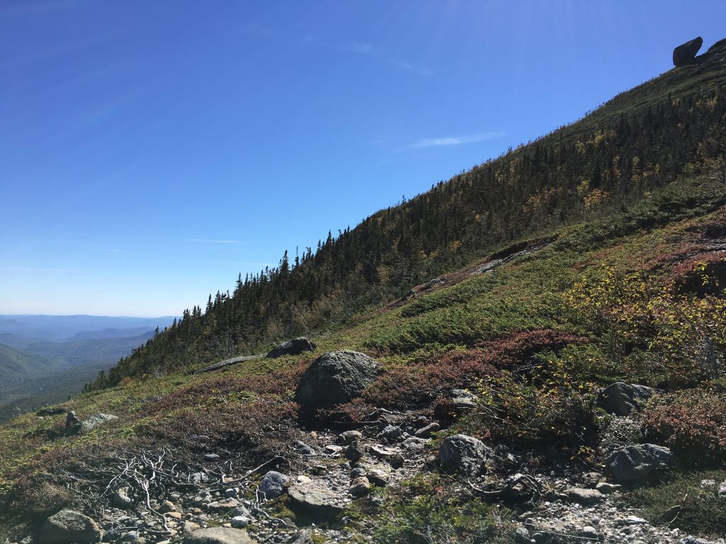
Pictures
Views of Wilcdats from Boott Spur
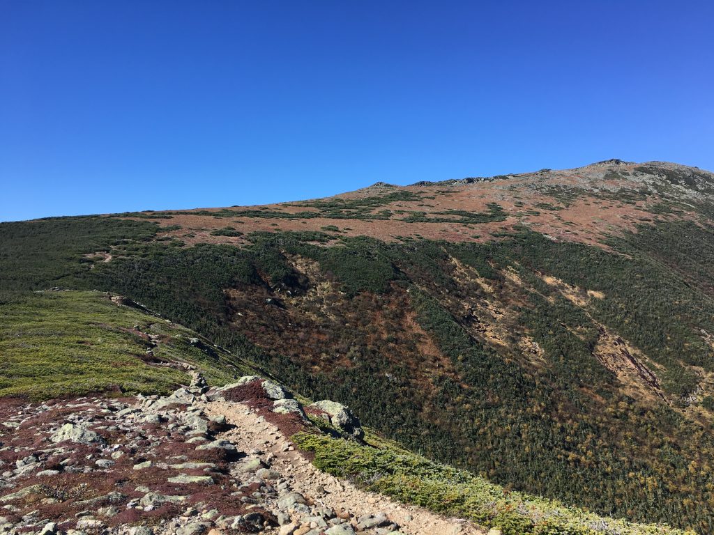
Views of Boott Spur
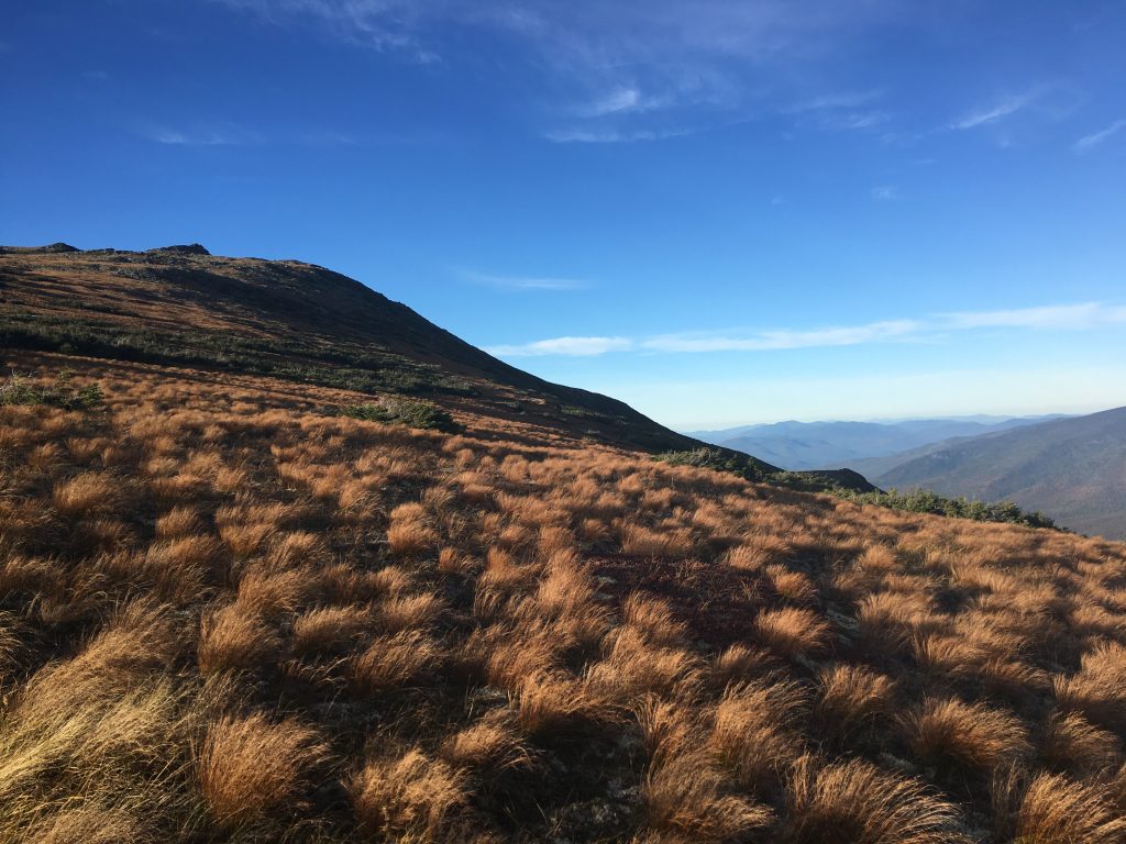
Mount Isolation Views
VIews of Glen Boulder
Max DesMarais is the founder of hikingandfishing.com. He has a passion for the outdoors and making outdoor education and adventure more accessible. Max is a published author for various outdoor adventure, travel, and marketing websites. He is an experienced hiker, backpacker, fly fisherman, backcountry skier, trail runner, and spends his free time in the outdoors. These adventures allow him to test gear, learn new skills, and experience new places so that he can educate others. Max grew up hiking all around New Hampshire and New England. He became obsessed with the New Hampshire mountains, and the NH 48, where he guided hikes and trail runs in the White Mountains. Since moving out west, Max has continued climbed all of the Colorado 14ers, is always testing gear, learning skills, gaining experience, and building his endurance for outdoor sports. You can read more about his experience here: hikingandfishing/about